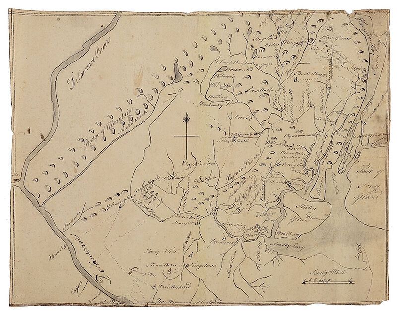
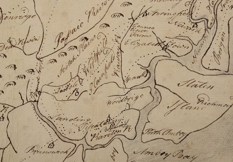
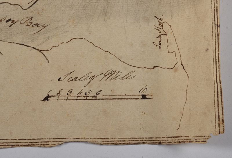
circa 1780, illustrating the trails and roads between the Delaware River and Hudson River, ink on laid paper, with crown watermark, 12-1/4 x 16 in.; unframedNote: The paths illustrated on this map follow those originally used by the Leni Lenape Indians and were still in use at the time of the Revolutionary War. From the place names identified, it is clear that this map illustrates an American viewpoint.McConkey?s Ferry, where Washington crossed the Delaware in December 1776, is located along the bottom of the map. Across the Delaware River, the roads leading into New Jersey are noted. Forts Lee, Independence and Washington along the Hudson River, captured by the British in 1776, are also included. The British destroyed Forts Lee and Independence.In addition to the notable battles fought in New Jersey, that colony was also key in disrupting British supply units. American forts along the Delaware River were able to attack British supply troops attempting to make their way to Philadelphia. Another important contribution to the war effort was the significant number of iron works that supplied weaponry for the American troops. Many of these are identified on this manuscript such as the location of Long Pond Ironworks, forge and furnace and Hibernia (site of the Stirling Forge).The ca. 1780 date was determined by the use of the word ?State? along the dotted line separating New Jersey from New York, as well as the appearance of ?Connecticut Farms? (just above Elizabethtown), notable as being one of the last major battles between Britain and America during the Revolution.It is possible that this manuscript map was drawn by John W. Sever (1766-1803), the brother of Capt. James Sever. Comparable handwriting appears in a letter from John to his brother James dated 1801 (included with lot 665). This handwriting is the same as in the map of New York harbor (lot 655)ÿand the manuscript map of Maine (lot 661)ÿthat also descended in the Sever family.ÿBoth this map and the map of New York harborÿhave similar lined borders, share some similar cursive characteristics, and the rivers and larger bodies of water were shaded, perhaps with graphite. Both maps were drawn on laid paper bearing watermarks consistent with paper used in America throughout the eighteenth century.Click here to read about this important American maritime collection from the Sever family and to view additional items from this collection. - Provenance: Captain James N. Sever (1761-1845), Captain USS Congress; by descent in family
Condition
wear and small tears to edges, left edge with small tear, scattered creasing, toning, and light staining throughout