November Premier Auction: Day 3
Sat, Nov 11, 2017 09:00AM EST - Sun, Nov 12, 2017 09:00AM EST
| Price | Bid Increment |
|---|---|
| $0 | $25 |
| $100 | $50 |
| $1,000 | $100 |
| $2,000 | $200 |
| $3,000 | $250 |
| $5,000 | $500 |
| $10,000 | $1,000 |
| $20,000 | $2,000 |
| $50,000 | $5,000 |
| $100,000 | $10,000 |
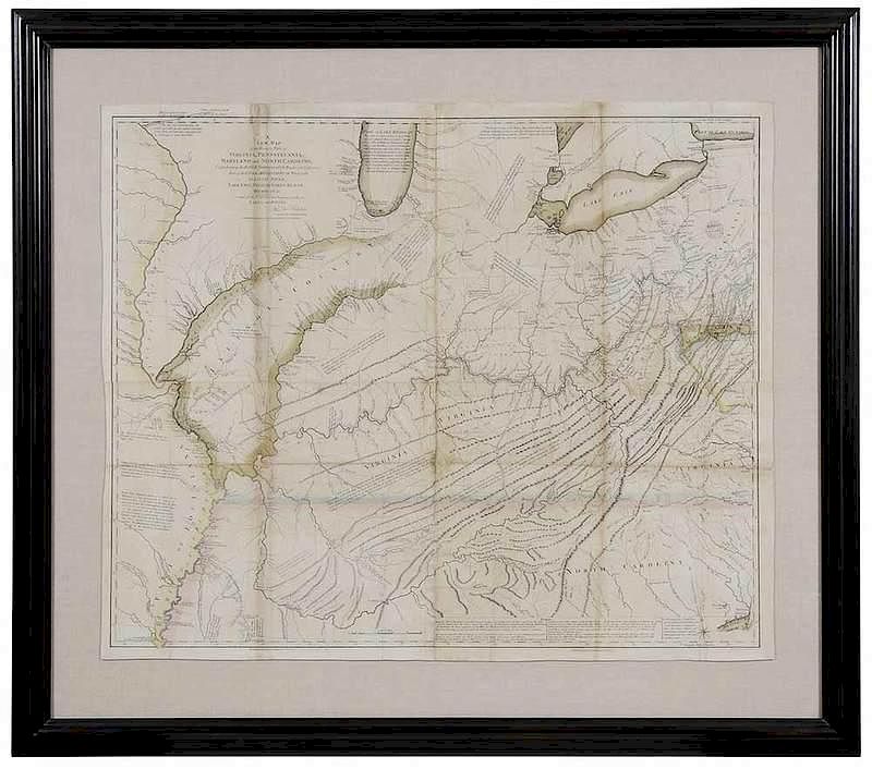
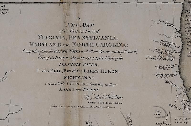
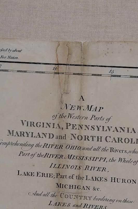
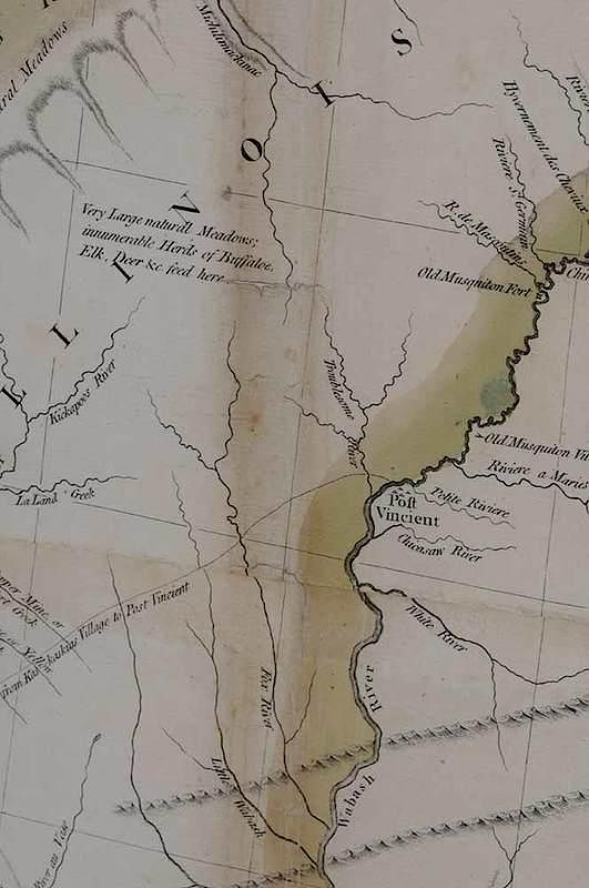
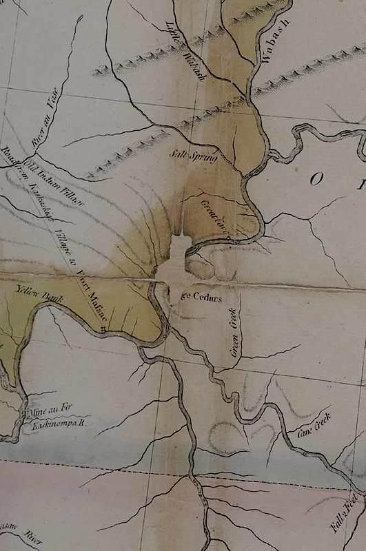
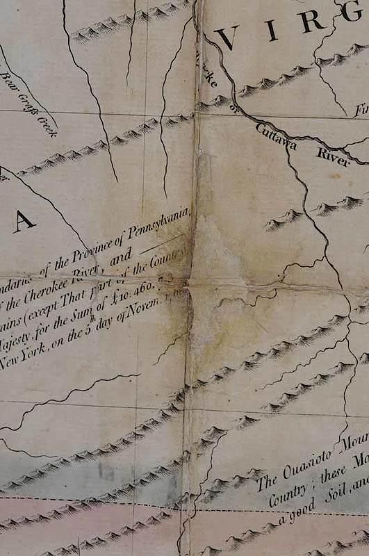
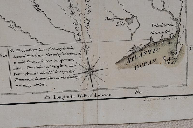
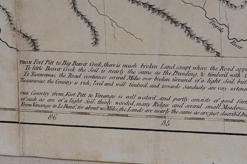
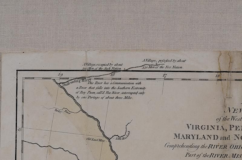
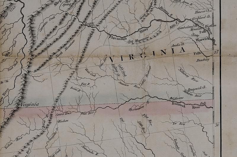
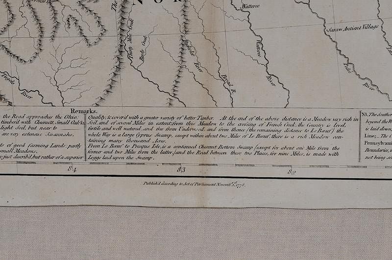
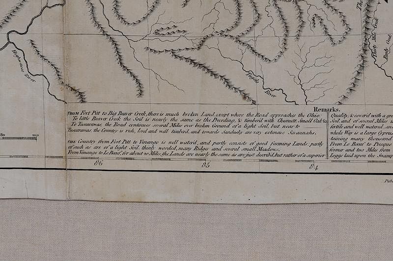
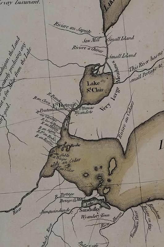
Thomas Hutchins (1730 - 1789), A New Map of The Western Parts of Virginia, Pennsylvania, Maryland And North Carolina; Comprehending The River Ohio, and All The Rivers, Which Fall Into It; Part of The River Mississippi, The Whole of The Illinois River, Lake Erie; Part of the Lakes Huron, Michigan & All the Country Bordering on these Lakes and Rivers. By Thos. Hutchins. Captain in the 60 Regiment of Foot, November 1, 1778, John Cheevers engraver, black and white line engraving with period hand color on laid paper, 35-1/4 x 43-1/2 in (overall); framed Notes: This copy was published in Pritchard & Taliaferrro, Degrees of Latitude: Mapping Colonial America, no. 49, fig 177, pp. 228-231. Thomas Hutchins, an officer in the 60th Royal American Regiment of Foot, enjoyed the reputation as a talented surveyor and engineer. He was provided the opportunity to conduct new surveys and explore areas not yet adequately mapped by the British. In addition to providing the first significant depiction of Trans-Appalachia, Hutchins included descriptions of the characteristics of the soil in various areas, places suitable for farming, the locations of meadowlands, timber, swamps, and deposits of salt, coal, petroleum, and lead. Buffalo hunting grounds were also indicated. Hutchins’s map was one of only a few to show Vandalia, here “Indiana,” proposed as the fourteenth colony during the late 1760s. Vandalia would have encompassed most of present-day West Virginia and Kentucky. Text in the upper left corner reads: A/ NEW MAP/ of the Western Parts of/ VIRGINIA, PENNSYLVANIA,/ MARYLAND and NORTH CAROLINA;/ Comprehending the RIVER OHIO, and all the RIvers, which fall into it;/ Part of the RIVER MISSISSIPPI, the Whole of the/ ILLINOIS RIVER,/ LAKE ERIE; Part of the LAKES HURON./ MICHIGAN &c./ And all the COUNTRY bordering on these/ LAKES and RIVERS./ By Tho.s Hutchins./ Captain in the 60 Regiment of Foot./ London, Published according to Act of Parliament Novemb.r y.e 1.st 1778 by T. Hutchins. The lower margin reads: Publish'd According to Act of Parliament 1.st Novemb.r 1778./ Publish'd according to Act of Parliament Novemb.r 1.st 1778. The lower right margin reads: Engrav'd by J. Cheevers This map was published to accompany A Topographical Description of Virginia, Pennsylvania, Maryland, and North Carolina, Comprehending the Rivers Ohio, Kenhawa, Sioto, Cherokee, Wabash, Illinois, Mississippi, &c. by Thomas Hutchins This copy exhibited: Degrees of Latitude: Mapping Early America; Milwaukee Art Museum, Wisconsin, March 21, 2003 - June 22, 2003; Concord Museum, Massachusetts, July 10, 2003 - October 19, 2003. Literature: Brown, Lloyd A., Early Maps of the Ohio Valley, pp. 124-125, #51; Cresswell, Donald H., "Colony to Commonwealth: The Eighteenth Century," in Stephenson, Richard W. and Marianne M. McKee, Virginia in Maps, pp. 58, 97-101, Map II-29A-D; Guthorn, Peter J., British Maps of the American Revolution pp. 30-31; Sellers John R. and Patricia M. Van Ee, Maps and Charts of North America and the West Indies, 1750-1789, p. 169, #789. Provenance: Colonial Williamsburg Foundation, Proceeds to Benefit the Acquisitions Fund
conserved at the Conservation Center for Art and Historical Artifacts on Paper in Philadelphia, floated, lined with Japan paper, some discoloration at folds, some restoration at folds and in margins, light toning
In house shipping. Brunk Auctions provides in-house shipping via UPS Ground (signature required) for many items. Brunk Auctions will provide a shipping quote which includes shipping, materials, labor and insurance. Insurance is based on the selling price and premium.
In order to provide an accurate shipping quote please provide the following:
Shipping arrangements are made only after the invoice is paid. The payment for shipping is a separate charge from payment of your lots.
Sales Tax: If you live in North Carolina and/or pick up from the auction house, and do not have a valid resale tax number on file with us, you MUST pay North Carolina state sales tax. The NC Sales Tax will not apply to any items being shipped out of state (unless the client resides in North Carolina) or to those clients with a resale tax number.