Premier Catalog Auctions - Session III
Sat, Sep 15, 2018 09:00AM EDT

| Price | Bid Increment |
|---|---|
| $0 | $25 |
| $100 | $50 |
| $1,000 | $100 |
| $2,000 | $200 |
| $3,000 | $250 |
| $5,000 | $500 |
| $10,000 | $1,000 |
| $20,000 | $2,000 |
| $50,000 | $5,000 |
| $100,000 | $10,000 |
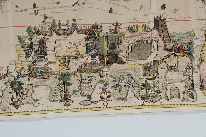
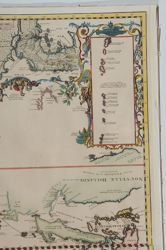
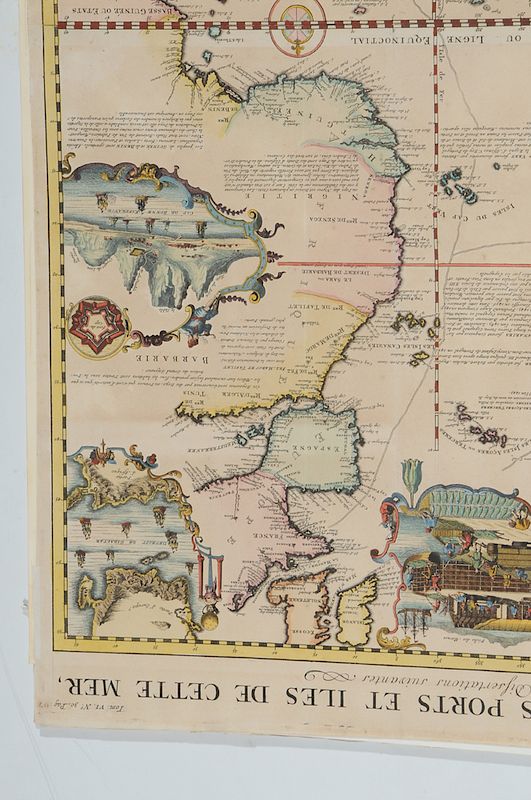
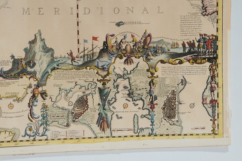
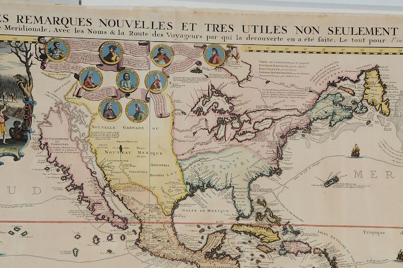
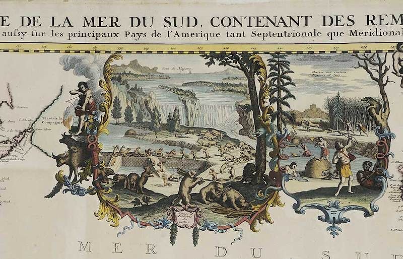
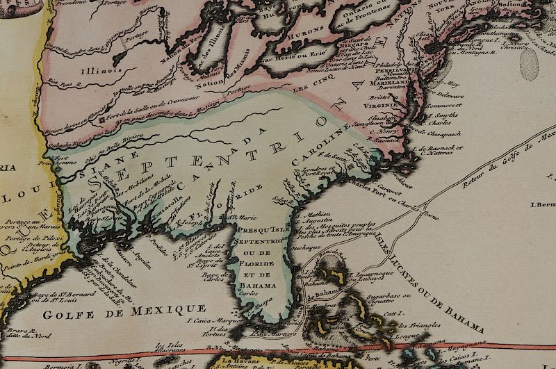
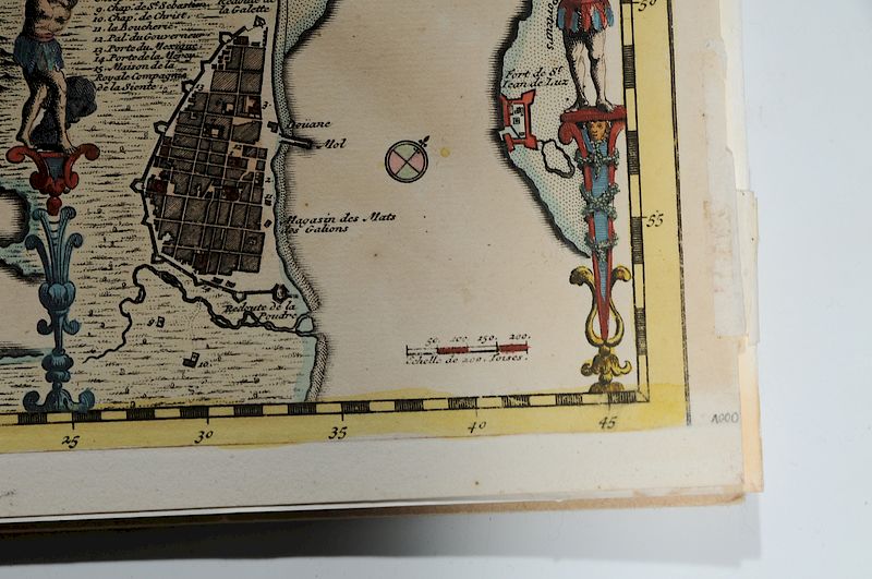
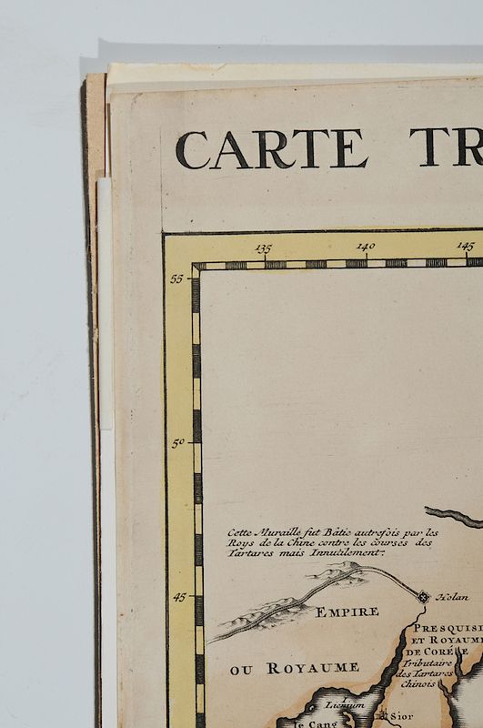
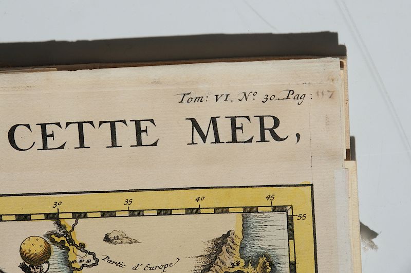
Henri Abraham Chatelain (1684-1743), Carte Tres Curieuse De La Mer Du Sud, Contenant Des Remarques Mouvelles Et Tres Utiles Non Seulement Sur Les Parts Et Iles De Cette Mer (Very Curious Map of the South Sea), Amsterdam, 1719, Francois l'Honore publisher, published in Atlas Historique, black and white line engraving with full hand color on multiple sheets of laid paper with Strasbourg Lily watermark, 33-5/8 x 57-1/4 in. (sheet); modern frame, 38-3/4 x 62-1/2 in.
Note: Notes: Seymour Schwartz noted that this is "One of the most elaborately engraved maps of the Western Hemisphere ever produced." in The Mapping of America, page 142. The upper margin reads: CARTE TRES CURIEUSE DE LA MER DU SUD, CONTENANT DES REMARQUES MOUVELLES ET TRES UTILES NON SEULEMENT SUR LES PARTS ET ILES DE CETTE MER,/ Mais aussy sur les principaux Pays de l'Amerique tant Septentrionale que Meridionale, Avec les Noms & la Route des Voyageurs par qui la decouverte en a ete faite, Le tout pour l'intelligence Des Dissertations suivantes.
Literature: Goss, John, The Mapping of North America: Three Centuries of Map-Making 1500-1860, 1990, pp. 116-117, Map 52; Tooley, R. V., “California as an Island: A Geographical Misconception Illustrated by 100 examples from 1625-1770,” in Tooley, R. V. ed., The Mapping of North America, p. 130, #80.
For a similar example, see Brunk Auctions November 9-11, 2017, Lot 1082
, Provenance: Private Collection, Charleston, South CarolinaIn house shipping. Brunk Auctions provides in-house shipping via UPS Ground (signature required) for many items. Brunk Auctions will provide a shipping quote which includes shipping, materials, labor and insurance. Insurance is based on the selling price and premium.
In order to provide an accurate shipping quote please provide the following:
Shipping arrangements are made only after the invoice is paid. The payment for shipping is a separate charge from payment of your lots.
Sales Tax: If you live in North Carolina and/or pick up from the auction house, and do not have a valid resale tax number on file with us, you MUST pay North Carolina state sales tax. The NC Sales Tax will not apply to any items being shipped out of state (unless the client resides in North Carolina) or to those clients with a resale tax number.