November Premier Auction: Day 3
Sat, Nov 11, 2017 09:00AM EST - Sun, Nov 12, 2017 09:00AM EST
| Price | Bid Increment |
|---|---|
| $0 | $25 |
| $100 | $50 |
| $1,000 | $100 |
| $2,000 | $200 |
| $3,000 | $250 |
| $5,000 | $500 |
| $10,000 | $1,000 |
| $20,000 | $2,000 |
| $50,000 | $5,000 |
| $100,000 | $10,000 |
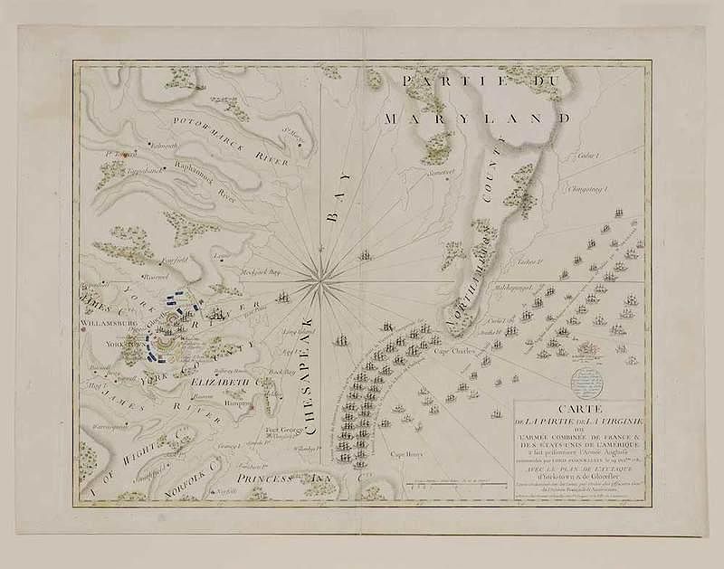
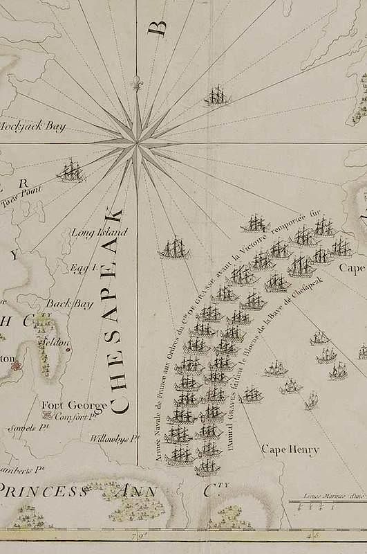
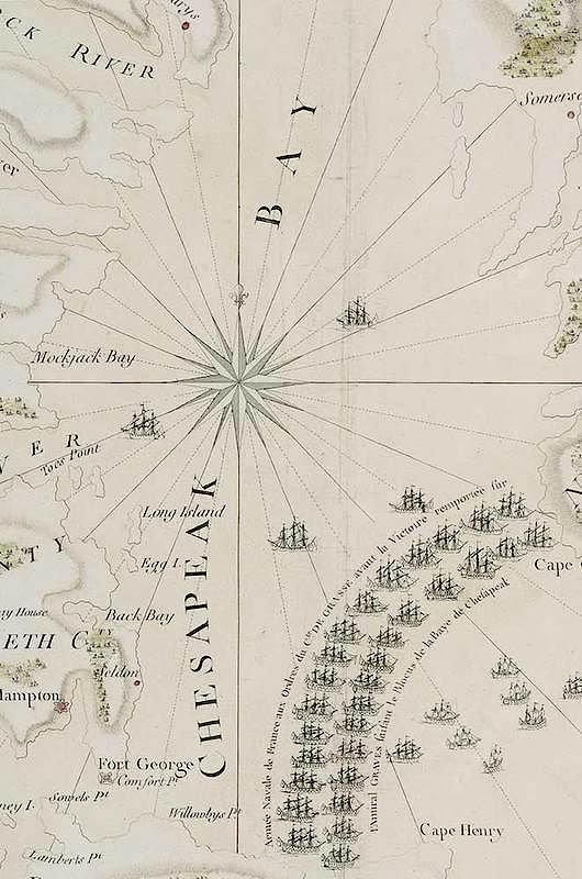
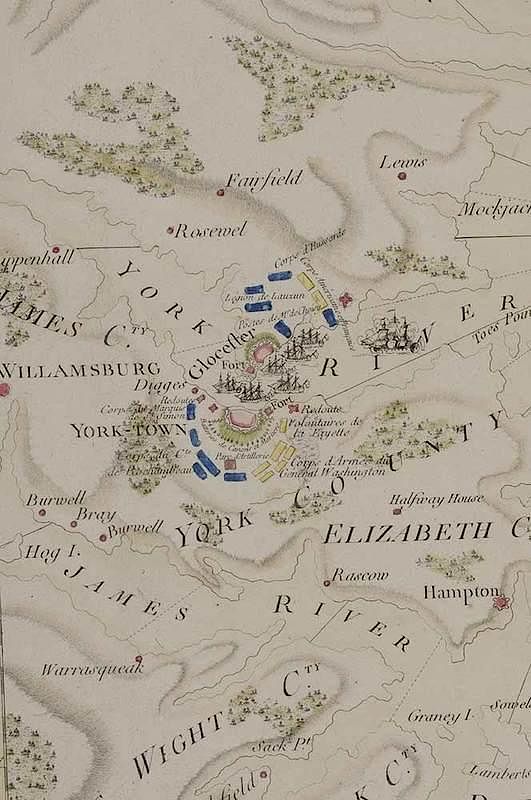
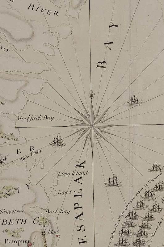
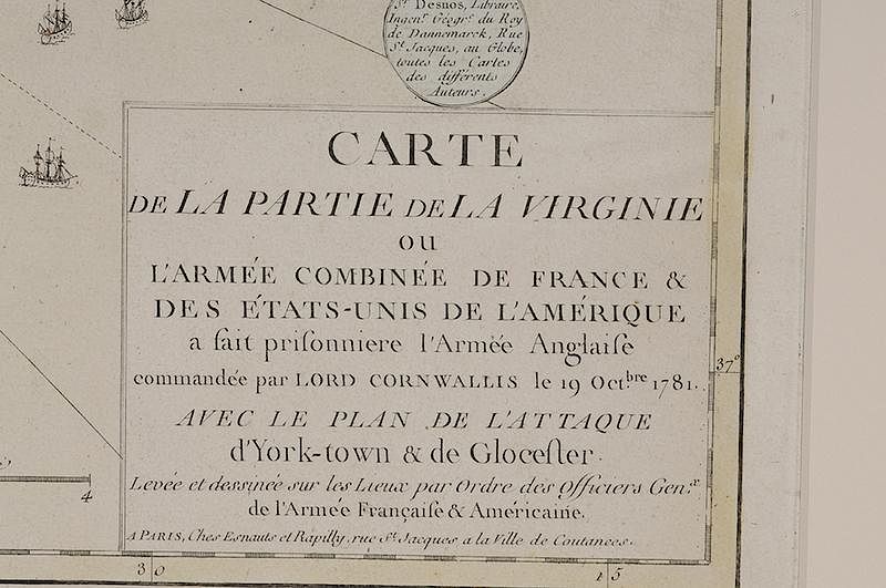
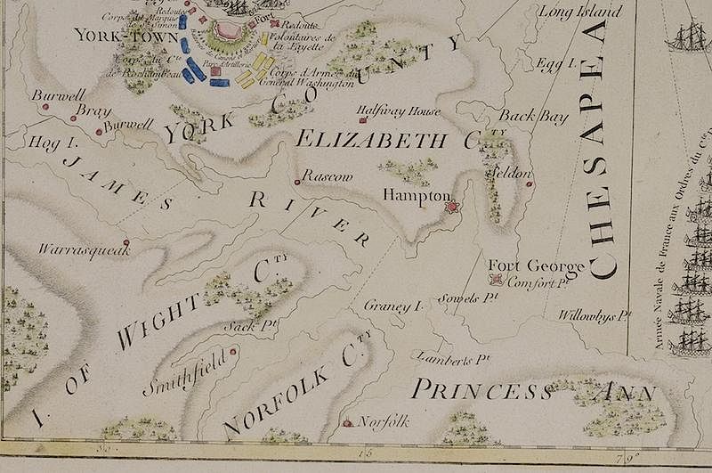
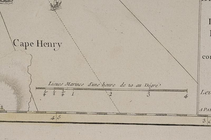
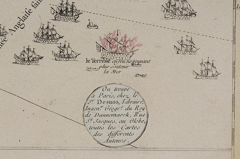
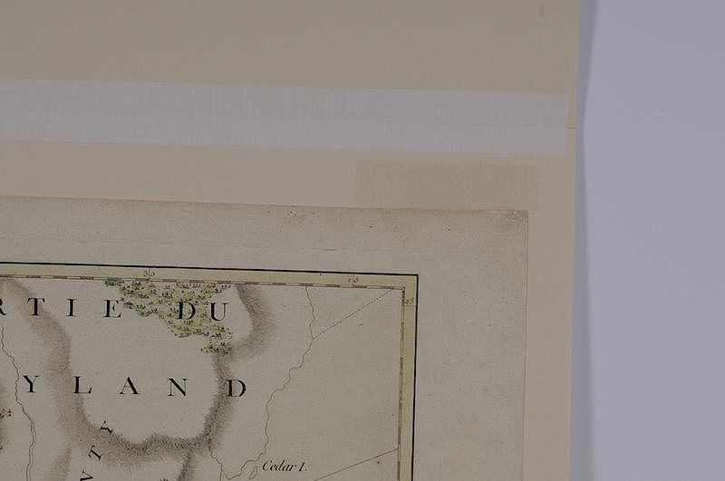
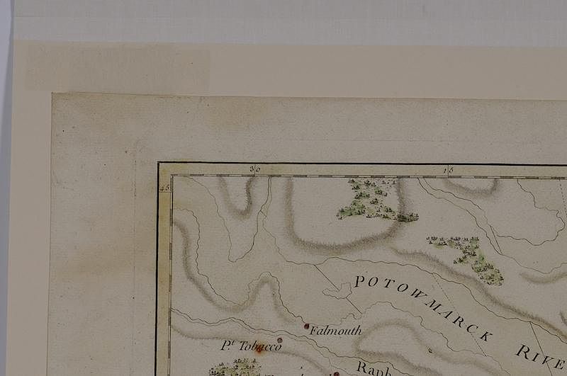
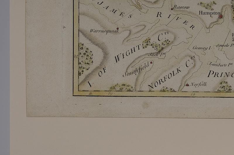
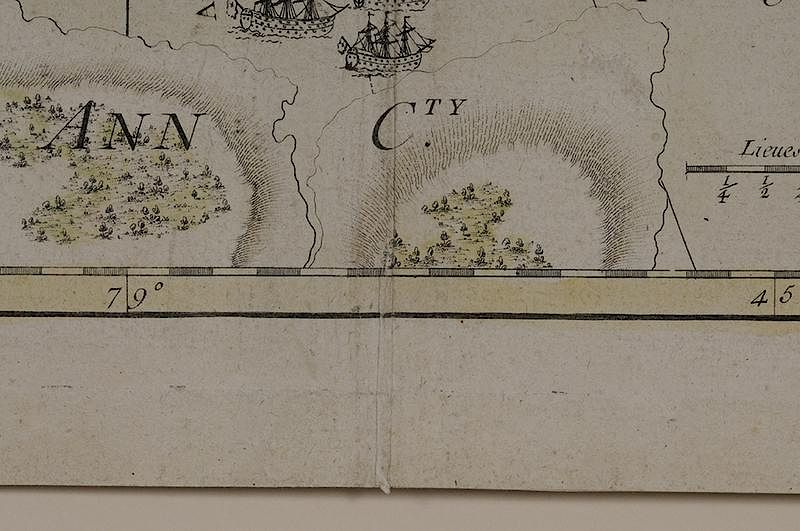
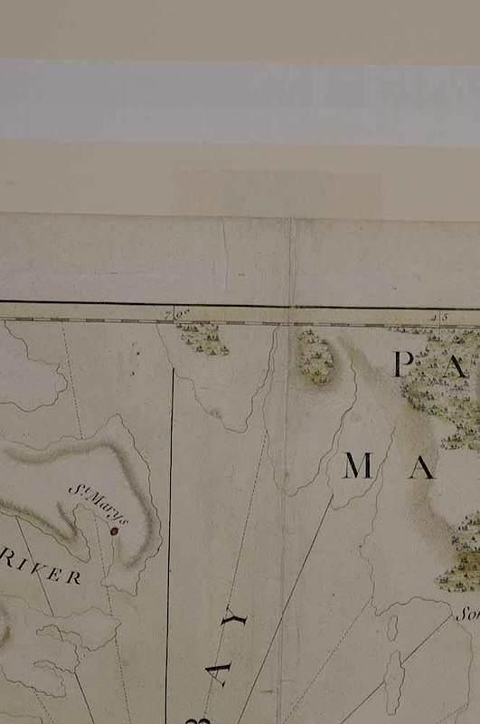
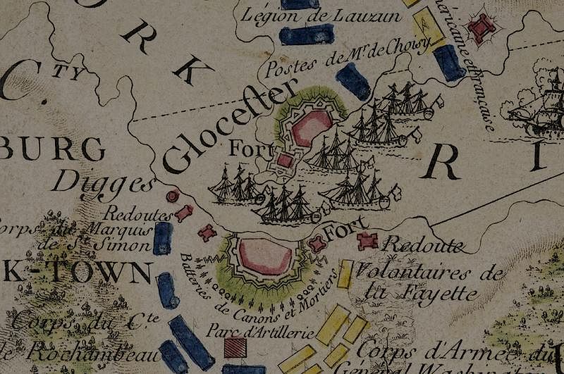
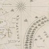
Esnauts & Rapilly (fl. circa 1775-1811), A Map of the Battle of Yorktown entitled Carte de la Partie de la Virginie ou L'Armée Combinée De France & Des États-Unis De L'Amérique a fait prisonniere l'Armée Anglaise commandée par Lord Cornwallis le 19 Oct.bre 1781., Circa 1782, Louis Charles Desnos (1725-1805), black and white engraving with period hand color on laid paper, 19 x 24-1/2 in.; framed Notes: This copy is published in Margaret B. Pritchard and Henry G. Taliaferro, Degrees of Latitude: Mapping Colonial America, pp. 282-285, #65. On August 14, 1781, General Washington received news that would shape his strategy for the remainder of the Revolutionary War. In order to support the American campaign, French Admiral François Joseph Paul, Comte de Grasse, had left the West Indies with a fleet of twenty-eight ships of the line, six frigates, and three thousand troops bound for the Chesapeake Bay. De Grasse arrived in the Chesapeake on August 26. When the British navy under the command of Admiral Thomas Graves appeared at the Virginia Capes on September 5, de Grasse dispatched his warships to the mouth of the bay. Although the ensuing battled lasted less than three hours, the British fleet was heavily damaged. Six of Graves' nineteen ships were temporarily taken out of action. The Terrible, illustrated in flames, was so mutilated that the British eventually had to destroy the vessel. This map depicts a dramatic, somewhat stylized version of the important role the French allies played in the American victory at Yorktown. Designed for the French market, it illustrates - and perhaps enhances - their position at the mouth of the Chesapeake Bay. It was obvious to the French people that Cornwallis could neither flee nor receive reinforcements. On page 169 of Mapping Virginia by William C. Wooldridge, he writes that this map "conveys more about French pride in the role they played than it does the actual disposition of the ships in the engagement... The oversized French ships are prominently arranged in a semicircle across the mouth of the Chesapeake (a formation they never actually took), sealing it off from the British. Other ships suggest the parallel array of the competing fleets in the actual battle. Here is a case of pictorial chest-thumping that depicted in cartographic form the larger reality - the French did effectively seal off the bay. This is the map's proud and accurate boast." The lower right cartouche reads: CARTE DE LA PARTIE DE LA VIRGINIE ou L'ARMÉE COMBINÉE DE FRANCE & DES ÉTATS-UNIS DE L'AMÉRIQUE a fait prisonniere l'Armée Anglaise commandée par LORD CORNWALLIS le 19 Oct.bre 1781. AVEC LE PLAN DE L'ATTAQUE d'York-town & de Glocester. Levée et dessinée sur les Lieux par Ordre des Officiers Gen.x de l'Armée Française & Américaine. A PARIS, Ches Esnauts et Rapilly, rue S.t Jacques a la Ville de Coutances. The circle above the cartouche reads: On trouve a Paris, chez le S.r Desnos, Libraire, Ingen.r Géog.e du Roy de Dannemarck, Rue S.t Jacques, au Globe, toutes les Cartes des différents Auteurs. Exhibition History: "Degrees of Latitude: Mapping Early America"; Milwaukee Art Museum, Wisconsin, March 21, 2003 - June 22, 2003; Concord Museum, Massachusetts, July 10, 2003 - October 19, 2003; DAR Museum, Washington D.C., November 14, 2003 - February 28, 2004. Literature: Cresswell, Donald H., "Colony to Commonwealth: The Eighteenth Century," in Stephenson, Richard W. and Marianne M. McKee, Virginia in Maps, pp. 61, 110-111, Map II-41; Nebenzahl, Kenneth. Atlas of the American Revolution, pp. 186-188, Map 49; Nebenzahl, Kenneth. A Bibliography of Printed Battle Plans of the American Revolution, 1775-1795, pp. 123-124, #193; Pritchard, Margaret B. and Henry G. Taliaferro, Degrees of Latitude: Mapping Colonial America, pp. 282-285, #65; Ristow, Walter W., American Maps and Mapmakers: Commercial Cartography in the Nineteenth Century, pp. 44-45; Sellers John R. and Patricia M. Van Ee, Maps and Charts of North America and the West Indies, 1750-1789, p. 316, #1462; Wooldridge, William C., Mapping Virginia, pp. 169-171, figure 153. Provenance: Colonial Williamsburg Foundation, Proceeds to Benefit the Acquisitions Fund
original color, full margins, small corrosion hole in upper left at "Pt. Tobacco" from original hand coloring, possible restoration at former hingepoints, examined and blacklit out of frame
In house shipping. Brunk Auctions provides in-house shipping via UPS Ground (signature required) for many items. Brunk Auctions will provide a shipping quote which includes shipping, materials, labor and insurance. Insurance is based on the selling price and premium.
In order to provide an accurate shipping quote please provide the following:
Shipping arrangements are made only after the invoice is paid. The payment for shipping is a separate charge from payment of your lots.
Sales Tax: If you live in North Carolina and/or pick up from the auction house, and do not have a valid resale tax number on file with us, you MUST pay North Carolina state sales tax. The NC Sales Tax will not apply to any items being shipped out of state (unless the client resides in North Carolina) or to those clients with a resale tax number.