Premier Auction | May 19, 2023
Fri, May 19, 2023 09:00AM EDT

| Price | Bid Increment |
|---|---|
| $0 | $25 |
| $100 | $50 |
| $1,000 | $100 |
| $2,000 | $200 |
| $3,000 | $250 |
| $5,000 | $500 |
| $10,000 | $1,000 |
| $20,000 | $2,000 |
| $50,000 | $5,000 |
| $100,000 | $10,000 |
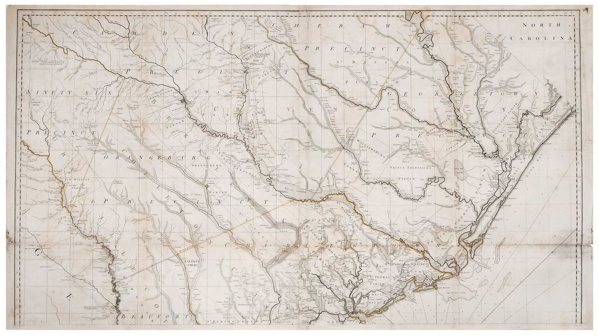
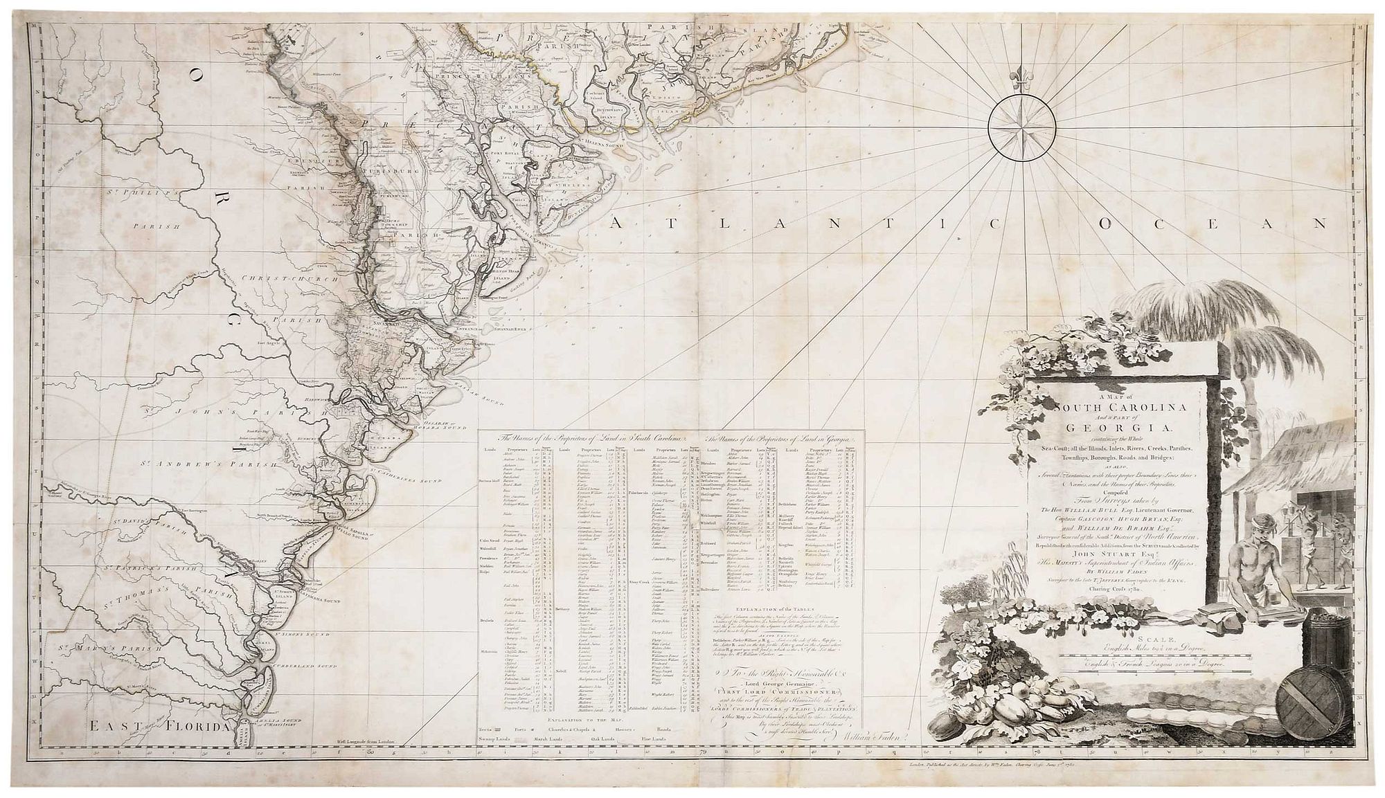
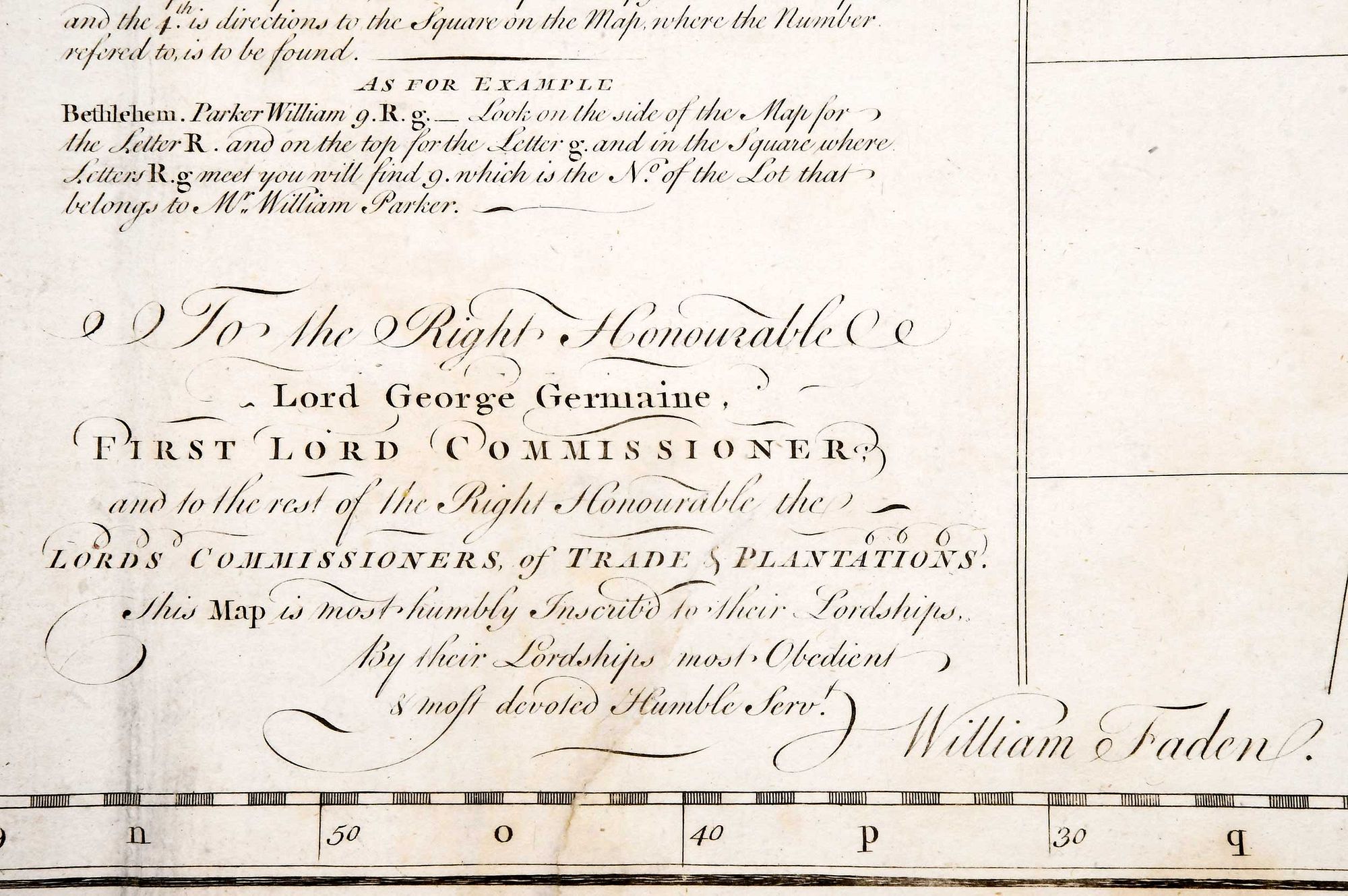
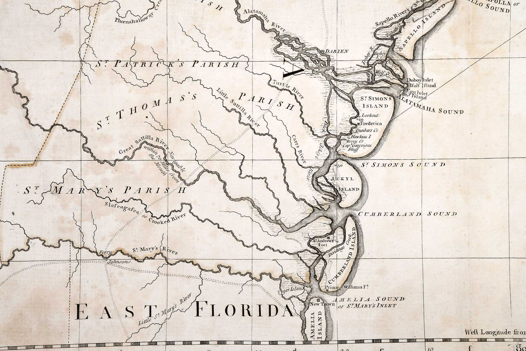
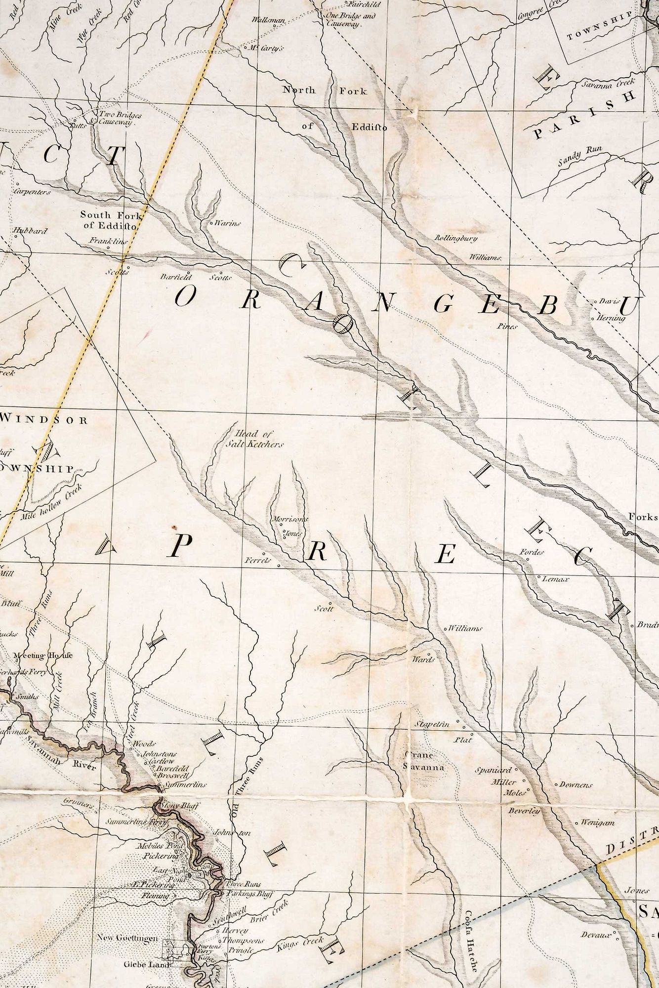
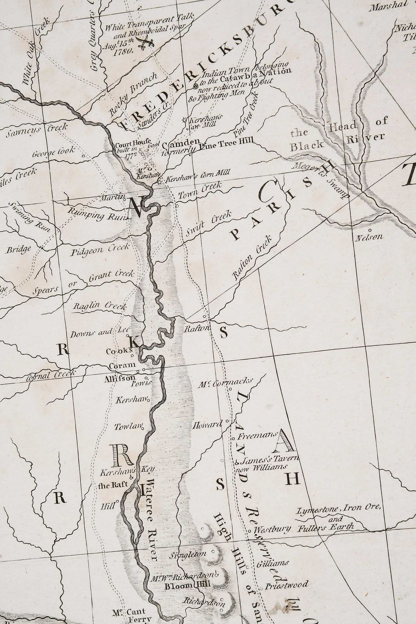
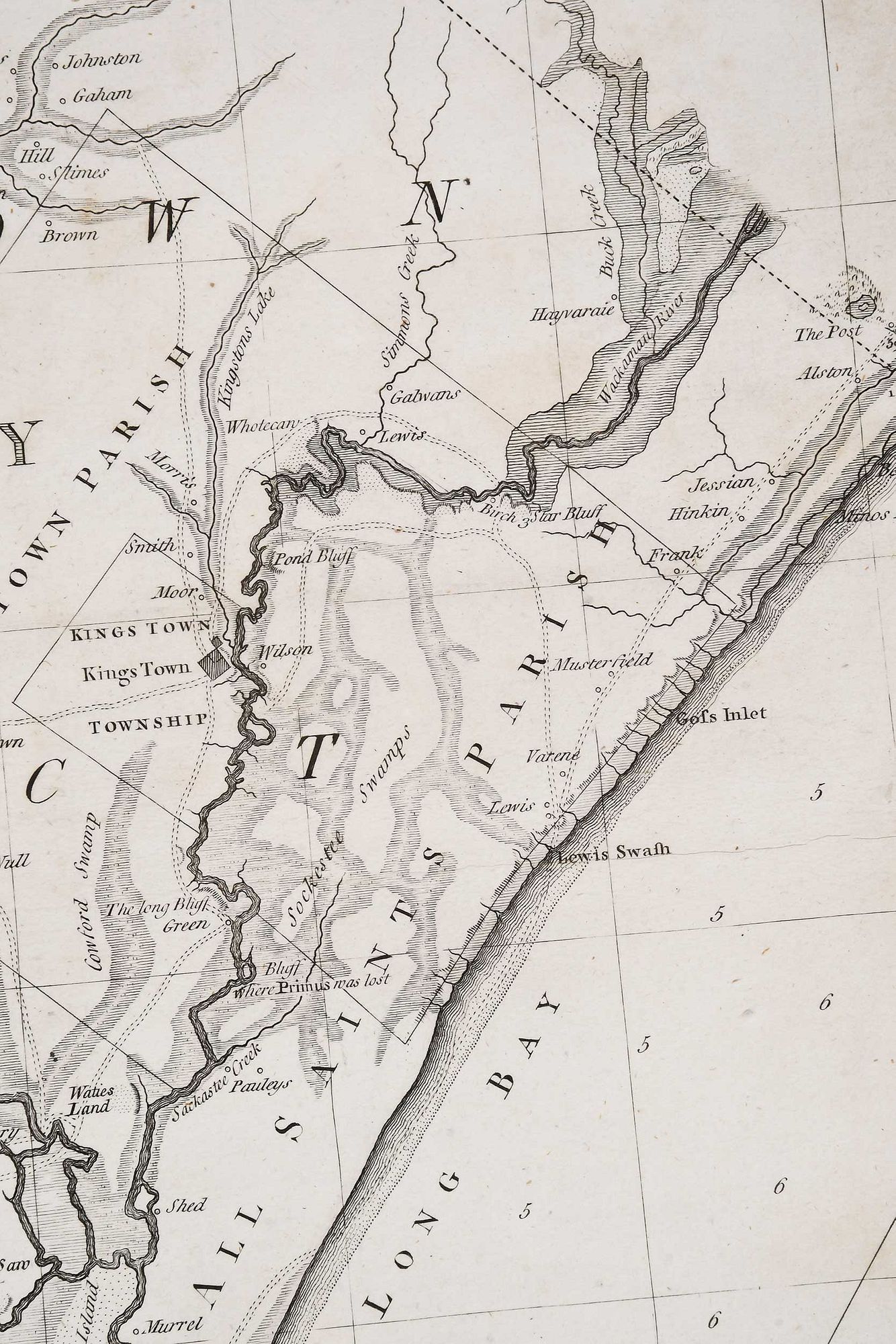
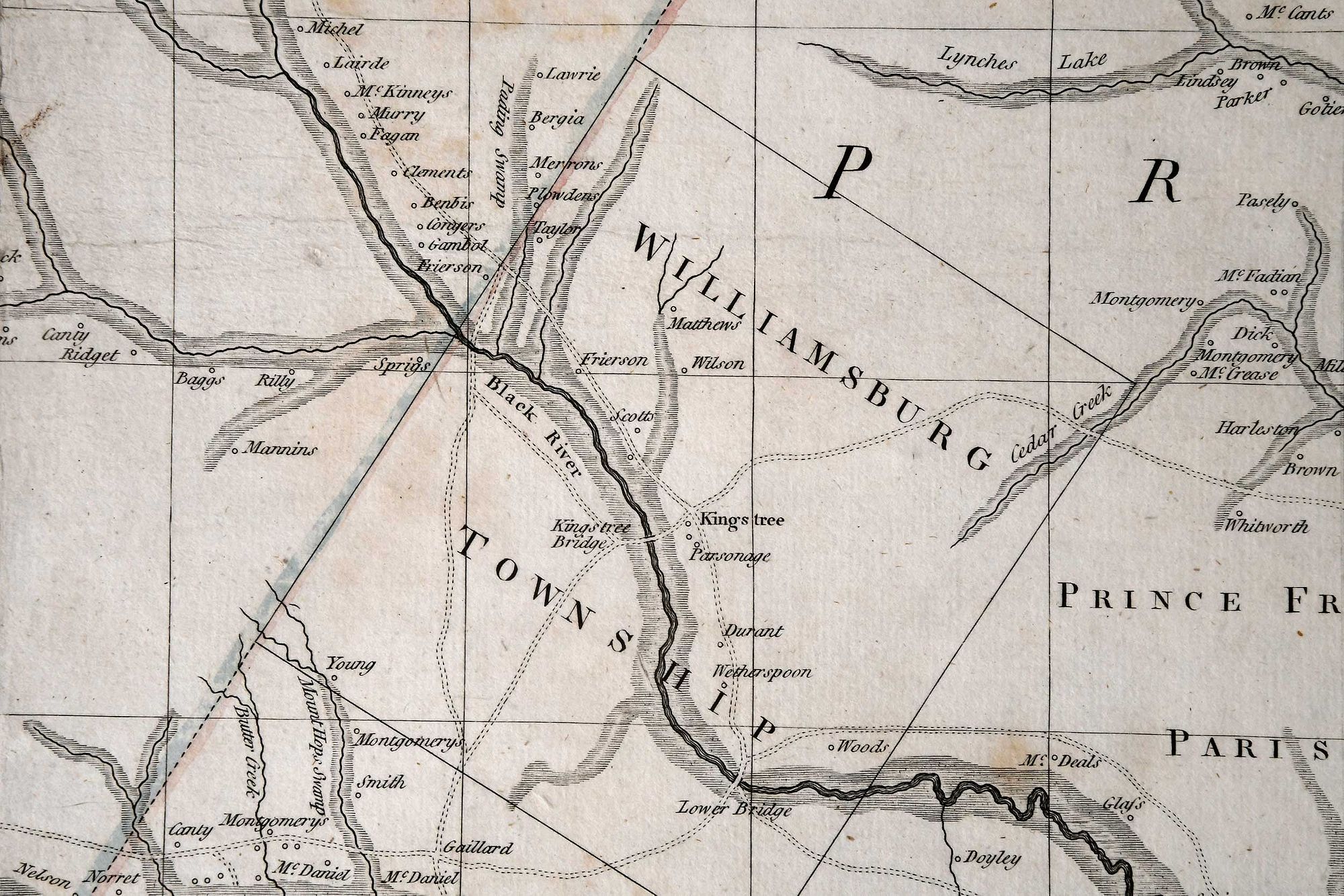
A Map of South Carolina And a Part of Georgia. Containing the Whole Sea Coast; all the Islands, Inlets, Rivers, Creeks, Parishes, Townships, Boroughs, Roads, and Bridges..., London, published by William Faden (1749-1836), 1780, second edition of De Brahm's 1757 map with additions and revisions by John Stuart (1718-1779), in four sheets, engraving on laid paper with minimal hand colored highlights, sheets 28-1/8 x 49 in. and 27-7/8 x 50-3/8 in.
laid down on two separate sheets of wove paper backing, some staining and losses to paper throughout (especially along fold lines), light wear to edges
Purchased items will be available for pick up or shipping from our Asheville, North Carolina auction facility within ten business days of the auction will be assessed a storage fee of $5.00 per day, per item. Purchaser agrees that packing and shipping is done at the purchaser's risk and that the purchaser will pay in advance all packing expenses, materials, carrier fees and insurance charges. At our discretion, items will either be packed by an agent such as a packaging store or Brunk Auctions. Please allow two weeks for shipping after payment is received. Shipment of large items is the responsibility of the purchaser. We are happy to provide names of carriers and shippers if a purchaser so requests. Brunk Auctions will have no liability for any loss or damage to shipped items.
Brad Rauschenberg, Winston-Salem, North Carolina