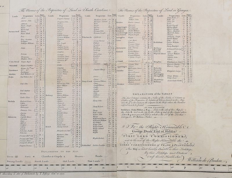
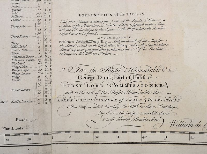
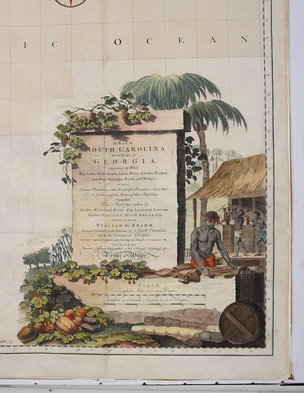
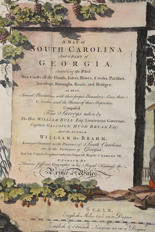
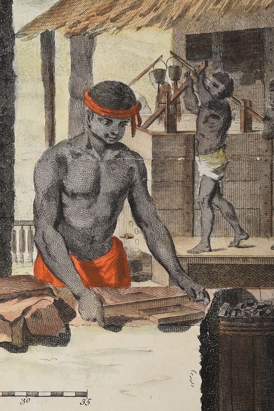
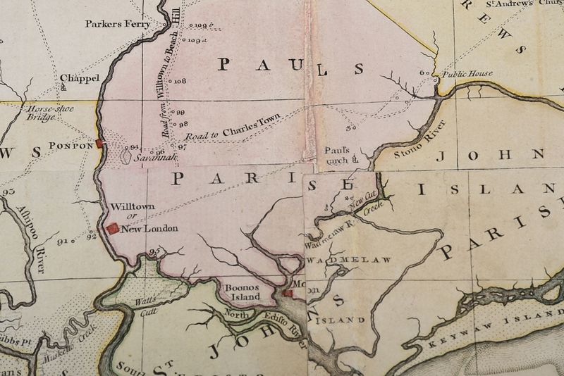
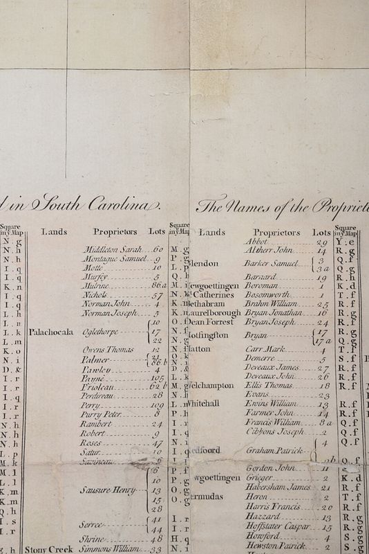
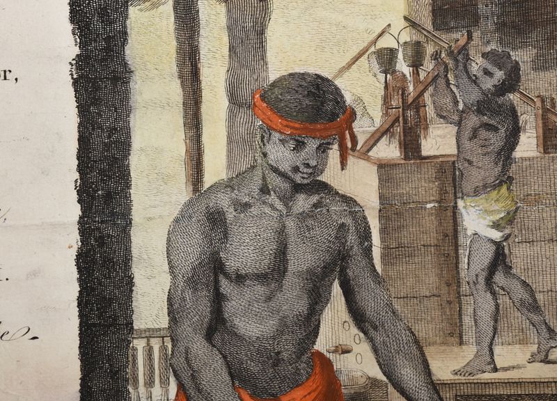
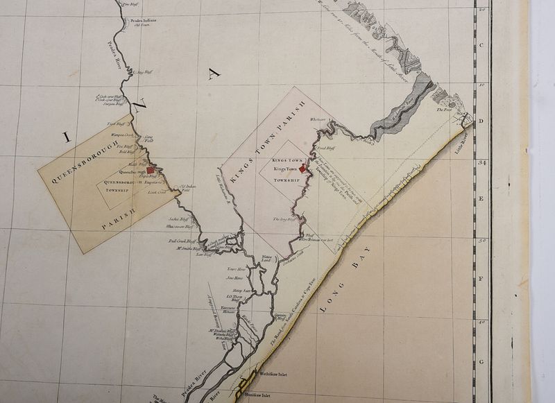
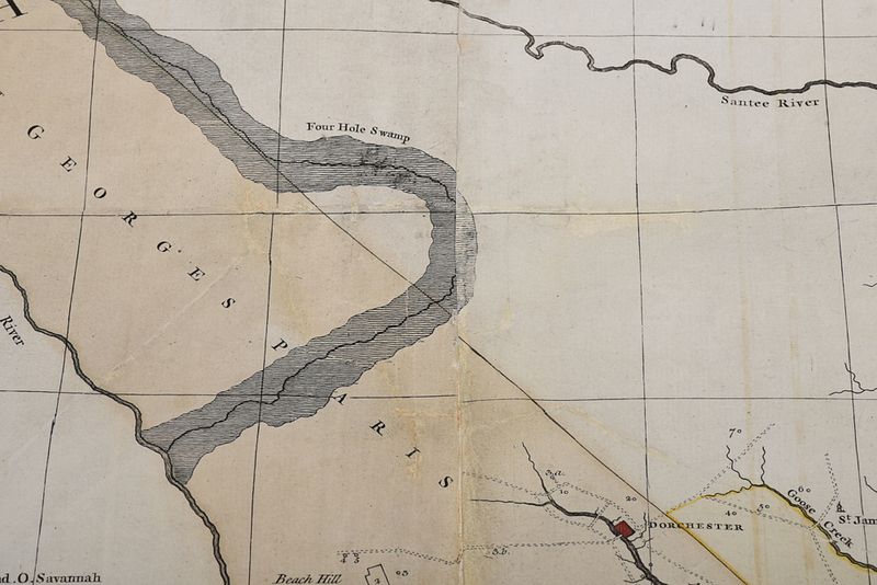
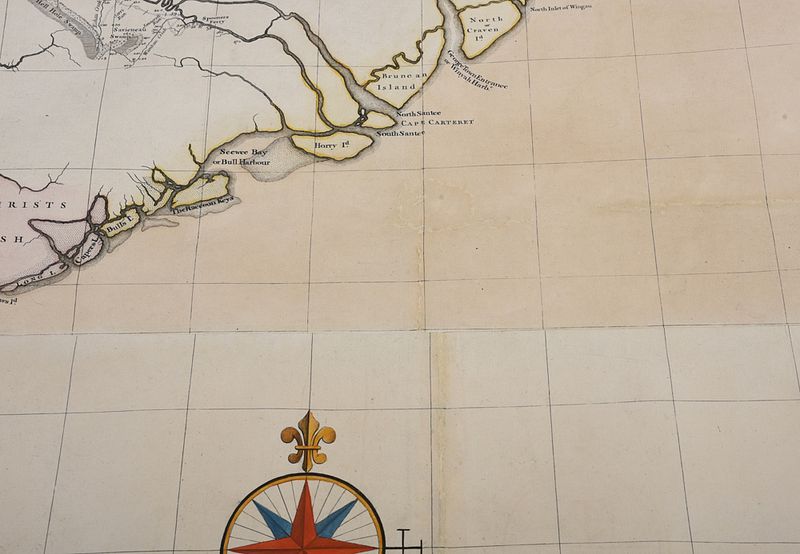
William Gerard De Brahm (German, 1717-1799), A Map of South Carolina and A Part of Georgia,ÿContaining the Whole Sea Coast; all the Islands, Inlets, Rivers, Creeks, Parishes, Townships, Boroughs, Roads and Bridges..., engraver and publisher Thomas Jefferys (English, 1719-1771),ÿLondon, in four sheets, line engraving on laid paper with hand colored highlights, with lists of "The Names of the Proprietors of Land..." in South Carolina and Georgia, decorative cartouche at lower right depicting a scene from the indigo dye production process, sheet 56 x 49-3/4 in.,ÿplate 53-3/4 x 49 in.; carved, painted, and gilt wood frame, 62 x 56-1/4 in. - Note: Being the first of two known editions, this magnificent, large scale map by De Brahm was one of the most important maps of the Georgia and South Carolina area produced during the British Colonial period. De Brahm, who immigrated to Georgia from Germany in 1751 following his retirement from the military, found work as a surveyor and was quickly recognized for his skill in the colonies, being commissioned to work on and oversee various projects, including the fortification of Charleston.De Brahm made his plans to produce the map public in 1752, during which time he conducted extensive field work and numerous surveys of the region, gathered data from local landowners, and drew upon previous maps and surveys. The resulting map was greater in quality and accuracy than any that had come before, with De Brahm's attention to topographical detail being particularly of note. According to Pritchard and Taliaferro, "De Brahm accurately illustrated the positions and courses of the rivers and their tributaries, located the many islands off the coast more correctly [than previous maps], and identified the parish settlements and boundaries on the South Carolina and Georgia coasts... He meticulously noted the marshlands, swamps, oat lands, and pine lands."A revised and re-titled version of the map was published in 1780.References: Pritchard, Margaret Beck, and Henry G. Taliaferro.ÿDegrees of Latitude: Mapping Colonial America. Williamsburg, Va: Colonial Williamsburg Foundation, in association with H.N. Abrams, 2002, pp. 184-187, fig. 147-149Cumming, William P.ÿBritish Maps of Colonial America. Chicago: Univ. of Chicago Press, 1974, p. 15De Vorsey, Louis.ÿWilliam Gerard De Brahm: Eccentric Genius of Southeastern Geography. 1970, pp. 21-29Schwartz, Seymour I., and Ralph E. Ehrenberg.ÿThe Mapping of America.ÿEdison, N.J.: Wellfleet, 2001, p. 167 - Provenance: Private Collection
Condition
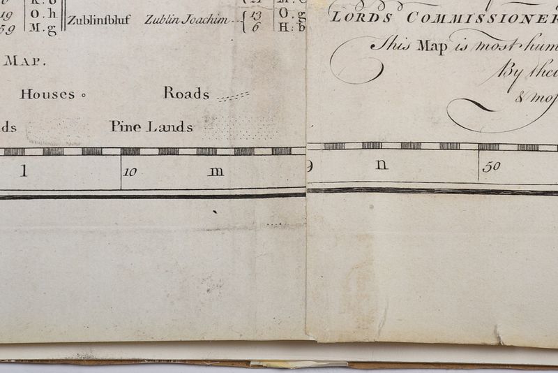
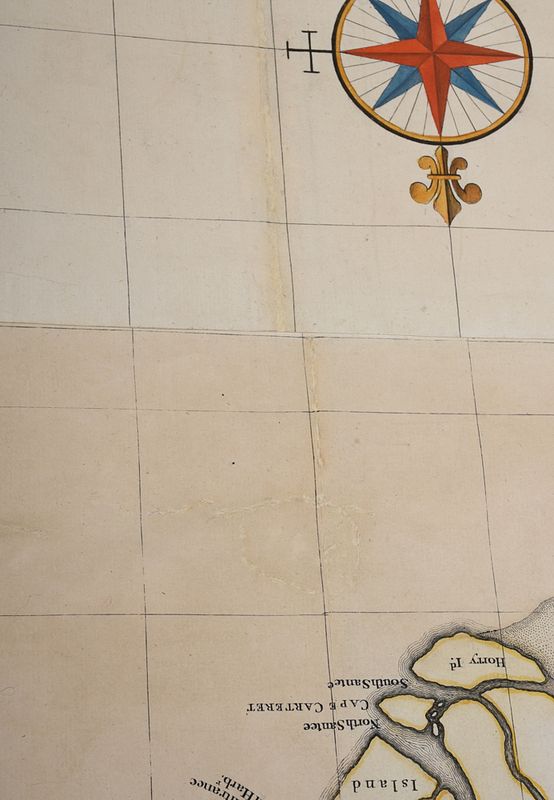
some recent coloring associated with conservation effort, especially at compass and cartouche, color generally good, light toning, some warping to paper throughout, horizontal and vertical fold lines, some printing creases, some wear and chipping to edges including some small tears, several restorations at lower center and center right, reinforced fold lines, pencil inscription and pinhole upper left verso, slightly misaligned at join lines; frame with minor wear