Collection of Jean and Jim Barrow | May 20, 2023
Sat, May 20, 2023 09:00AM EDT

| Price | Bid Increment |
|---|---|
| $0 | $25 |
| $100 | $50 |
| $1,000 | $100 |
| $2,000 | $200 |
| $3,000 | $250 |
| $5,000 | $500 |
| $10,000 | $1,000 |
| $20,000 | $2,000 |
| $50,000 | $5,000 |
| $100,000 | $10,000 |
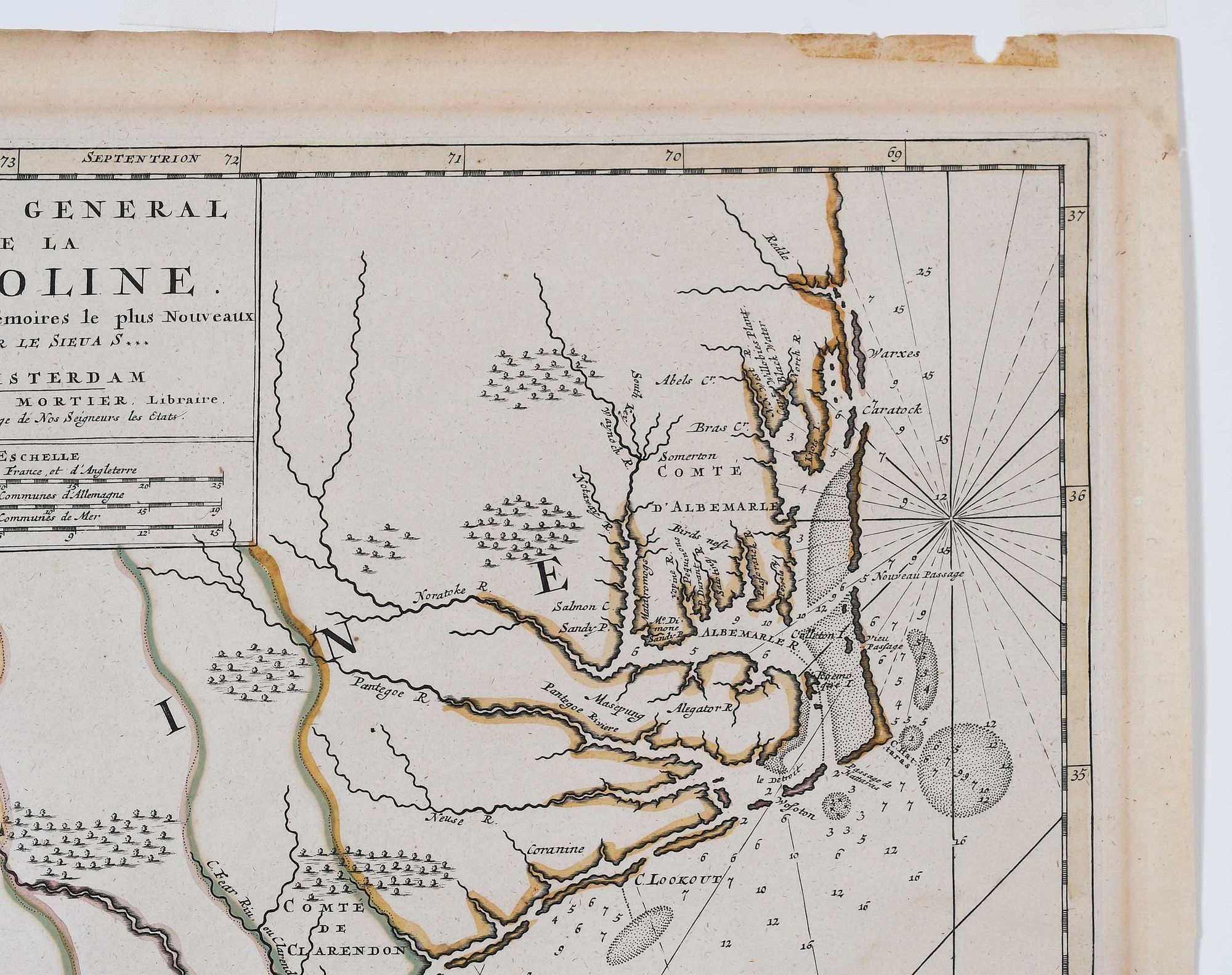
Pierre Mortier (1661-1711), Carte General de la Caroline, Amsterdam, 1696, from Sanson's Atlas Nouveau Contenant Toutes les Paries du Monde, first state, engraving on laid paper with hand colored highlights, 22-1/2 x 18-1/2 in., sheet 25-1/4 x 20 in.; carved wood frame, 31-7/8 x 27-7/8 in.
Note: Literature: Cumming, The Southeast in Early Maps, Chapel Hill: University of North Carolina Press, 1998, pg. 187, map 120.
hinged in on mat with archival tape, some toning and mat burn at edges, tape residue at top edge, water stain at right, small repair at right edge, some creasing; frame with light wear
Purchased items will be available for pick up or shipping from our Asheville, North Carolina auction facility within ten business days of the auction will be assessed a storage fee of $5.00 per day, per item. Purchaser agrees that packing and shipping is done at the purchaser's risk and that the purchaser will pay in advance all packing expenses, materials, carrier fees and insurance charges. At our discretion, items will either be packed by an agent such as a packaging store or Brunk Auctions. Please allow two weeks for shipping after payment is received. Shipment of large items is the responsibility of the purchaser. We are happy to provide names of carriers and shippers if a purchaser so requests. Brunk Auctions will have no liability for any loss or damage to shipped items.
Richard B. Arkway, Inc., New York, NY (label verso); Collection of Jean and Jim Barrow