Premier Catalog Auctions - Session III
Sat, Sep 15, 2018 09:00AM EDT

| Price | Bid Increment |
|---|---|
| $0 | $25 |
| $100 | $50 |
| $1,000 | $100 |
| $2,000 | $200 |
| $3,000 | $250 |
| $5,000 | $500 |
| $10,000 | $1,000 |
| $20,000 | $2,000 |
| $50,000 | $5,000 |
| $100,000 | $10,000 |
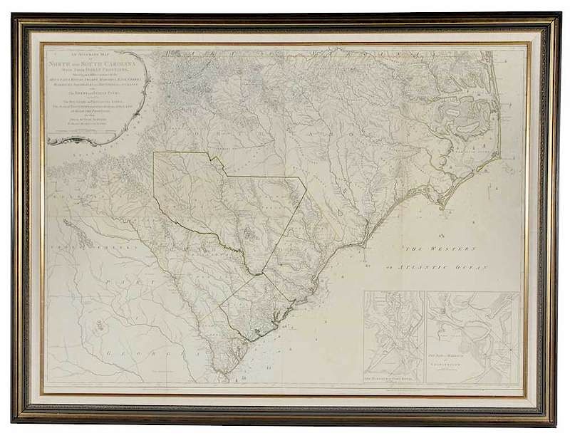
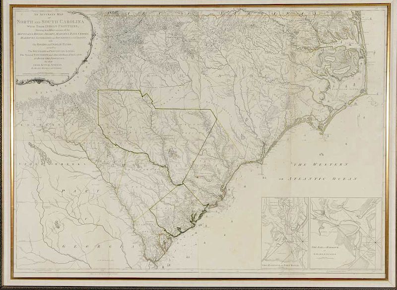
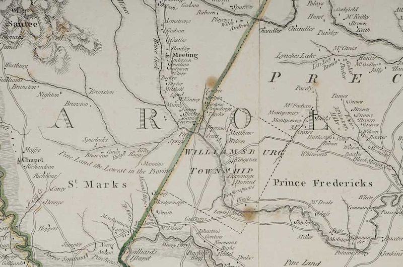
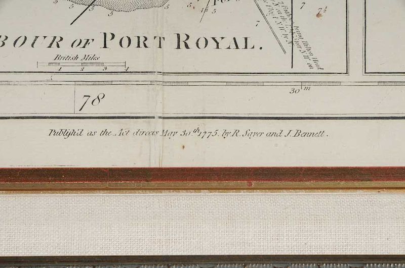
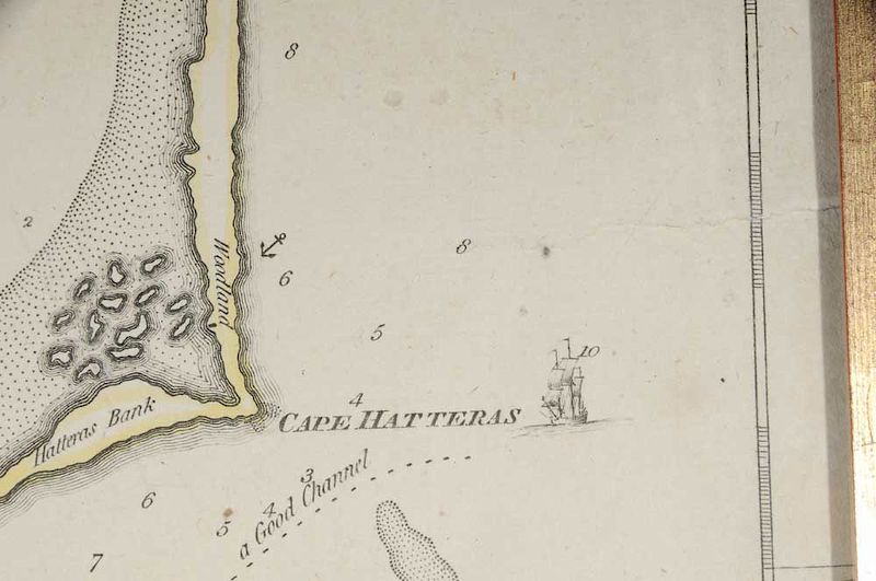
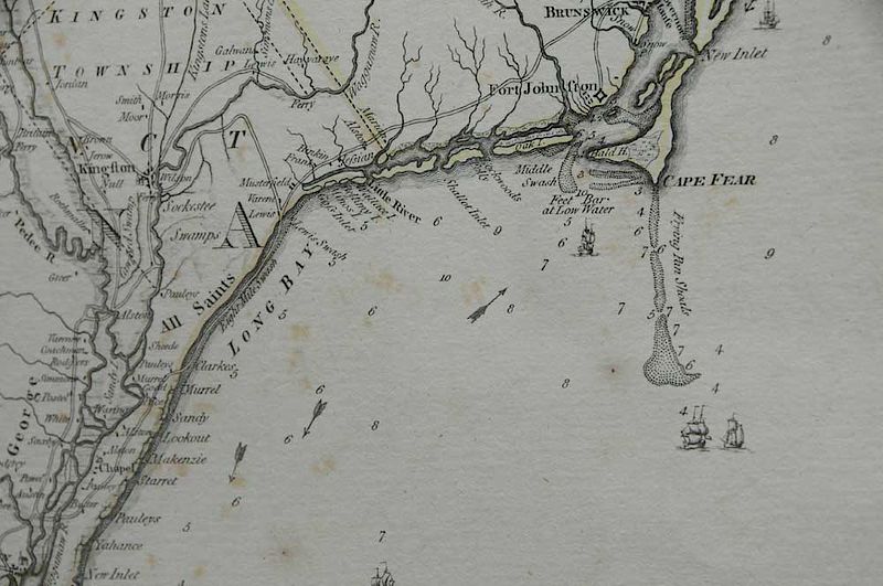
Henry Mouzon (1741 - 1807) An Accurate Map of North and South Carolina with their Indian Frontiers..., Published May 30th, 1775, Samuel Turner Sparrow (engraver), Robert Sayer (Publisher), John Bennett (Publisher), black and white line engraving with period outline hand color on laid paper, 40-1/4 x 55-5/8 in. (sight), framed
Note: The Mouzon Map of North and South Carolina was the most important map of the region during the Revolutionary War. It was the chief map of the region nearly 50 years. George Washington's personal copy is held in collections of the library of the American Geographical Society.
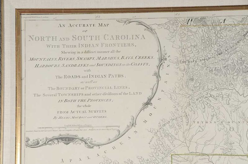
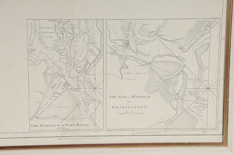
The Cartouche Reads: AN ACCURATE MAP / OF / NORTH AND SOUTH CAROLINA / WITH THEIR INDIAN FRONTIERS, / Shewing in a distinct manner all the / MOUNTAINS, RIVERS, SWAMPS, MARSHES, BAYS, CREEKS, / HARBORS, SANDBANKS and SOUNDINGS on the COASTS; / with / The ROADS and INDIAN PATHS; / as well as / The BOUNDARY or PROVINCIAL LINES, / The Several TOWNSHIPS and other divisions of the LAND / IN BOTH THE PROVINCES; / the whole / FROM ACTUAL SURVEYS / By HENRY MOUZON and OTHERS
The area below the scale reads: LONDON, Printed for Rob.t Sayer and J: Bennett, Map and Print-Sellers, No 53 in Fleet Street. Published as the Act directs May 30th 1775
The Lower Left and Right Margins Read: Publish'd as the Act directs May 30th 1775. by R: Sayer & J: Bennett
Literature:
Cumming, William, North Carolina in Maps, pp. 21-22
Cumming, William, The Southeast in Early Maps, #450, pp. 449-450
Pritchard and Taliaferro, Degrees of Latitude: Mapping Colonial America, #44, figures 163, 164, pp. 208-211
, Provenance: Bought from a British Estate; Private Cashiers, North Carolina CollectionIn house shipping. Brunk Auctions provides in-house shipping via UPS Ground (signature required) for many items. Brunk Auctions will provide a shipping quote which includes shipping, materials, labor and insurance. Insurance is based on the selling price and premium.
In order to provide an accurate shipping quote please provide the following:
Shipping arrangements are made only after the invoice is paid. The payment for shipping is a separate charge from payment of your lots.
Sales Tax: If you live in North Carolina and/or pick up from the auction house, and do not have a valid resale tax number on file with us, you MUST pay North Carolina state sales tax. The NC Sales Tax will not apply to any items being shipped out of state (unless the client resides in North Carolina) or to those clients with a resale tax number.