Emporium & Humber Family Collection Auction
Fri, Feb 4, 2022 09:00AM EST

| Price | Bid Increment |
|---|---|
| $0 | $25 |
| $100 | $50 |
| $1,000 | $100 |
| $2,000 | $200 |
| $3,000 | $250 |
| $5,000 | $500 |
| $10,000 | $1,000 |
| $20,000 | $2,000 |
| $50,000 | $5,000 |
| $100,000 | $10,000 |
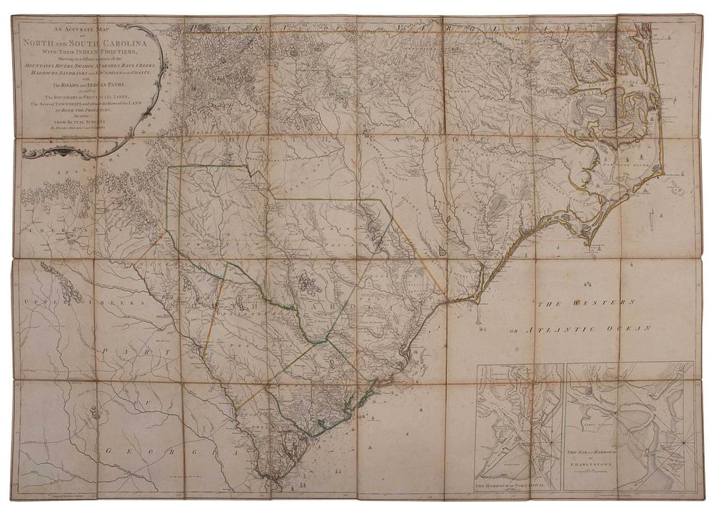
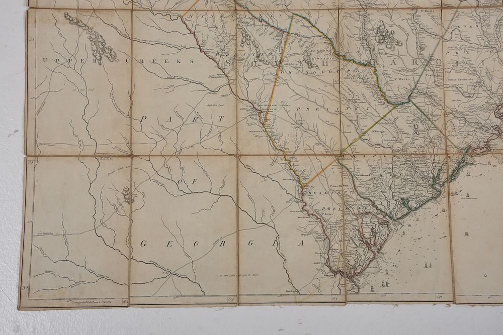
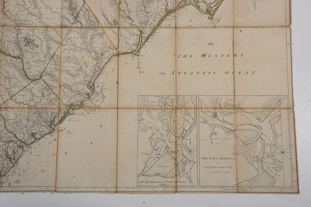
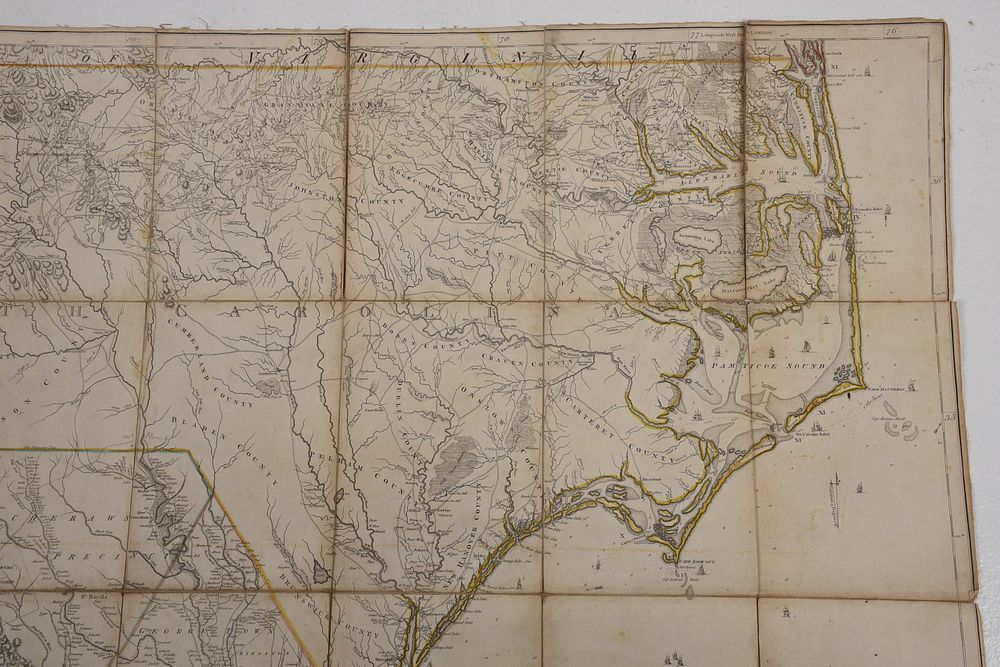
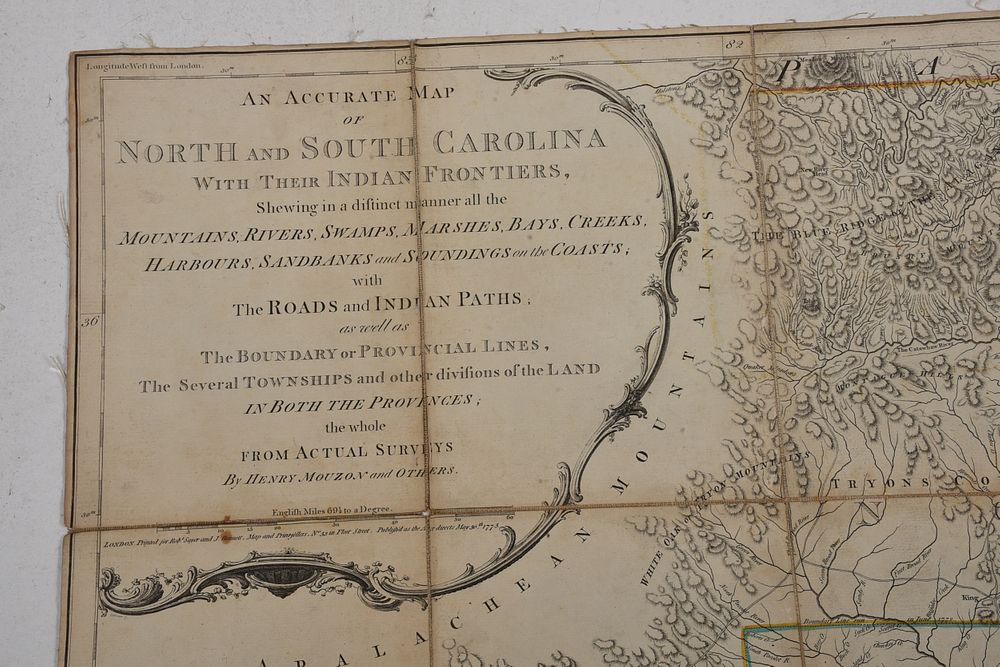
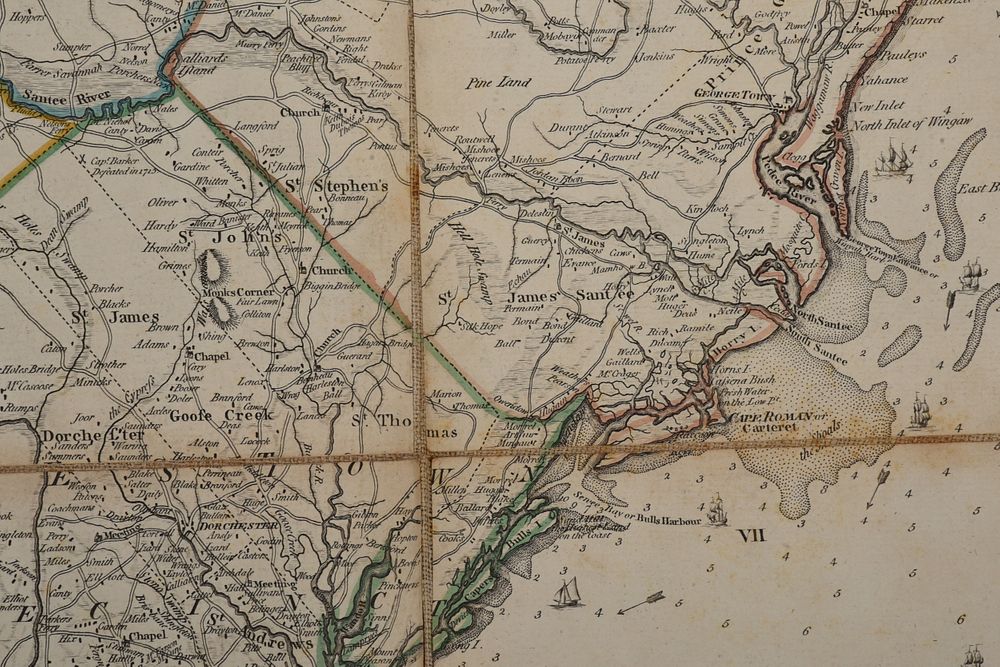
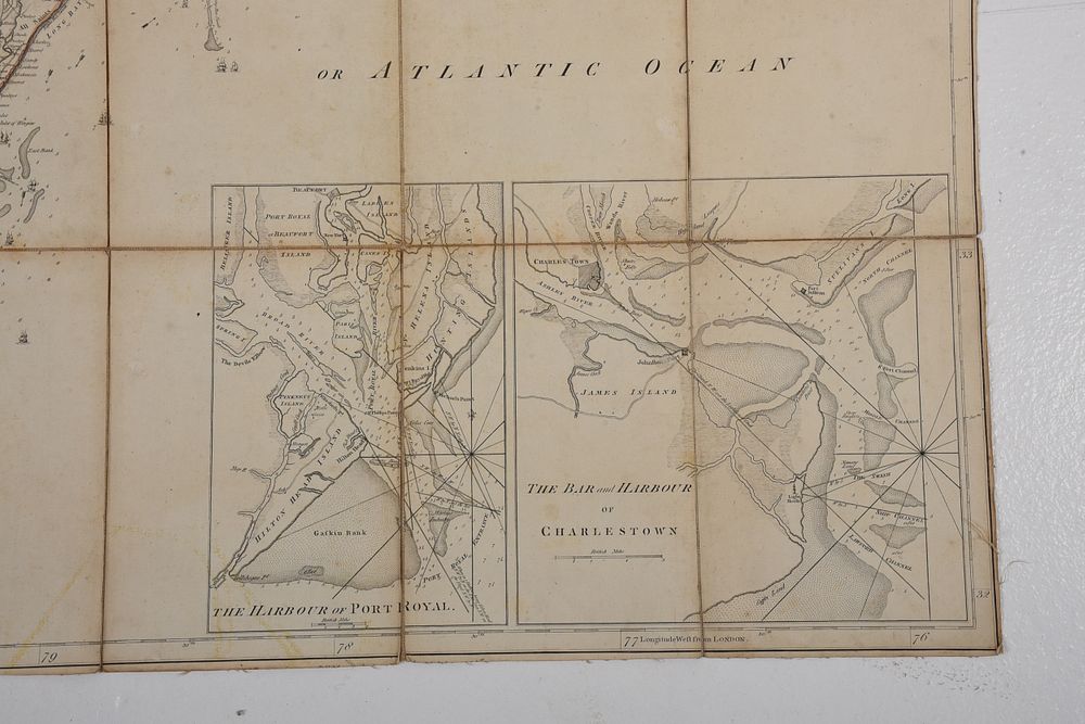
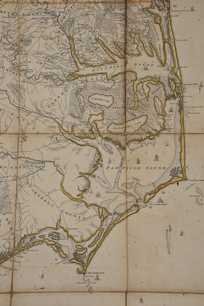
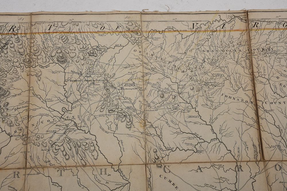
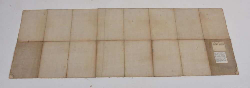
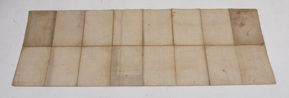
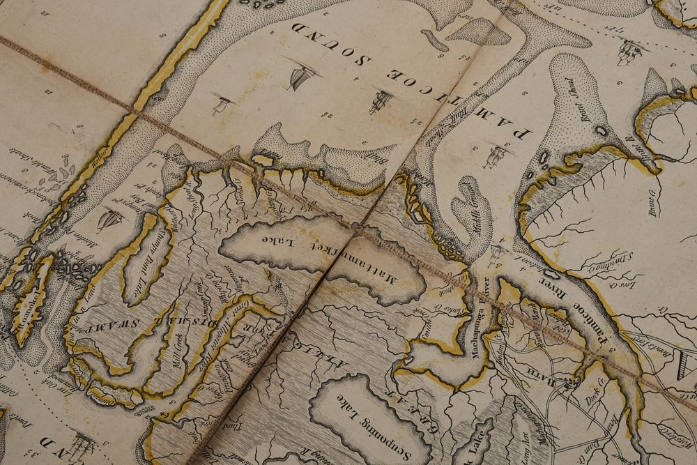
Henry Mouzon (1741-1807), An Accurate Map of North and South Carolina With Their Indian Frontiers, Shewing in a distinct manner all the Mountains, Rivers, Swamps, Marshes, Bays, Creek, Harbours, Sandbanks and Soundings on the Coast..., London, 1776, probably second state with addition of "Fort Sullivan", originally in four sheets, now cut and laid on linen, engraving on laid paper with hand colored highlights, with inset maps of Charleston Harbor and Port Royal Harbor, 40 x 56-1/4 in.
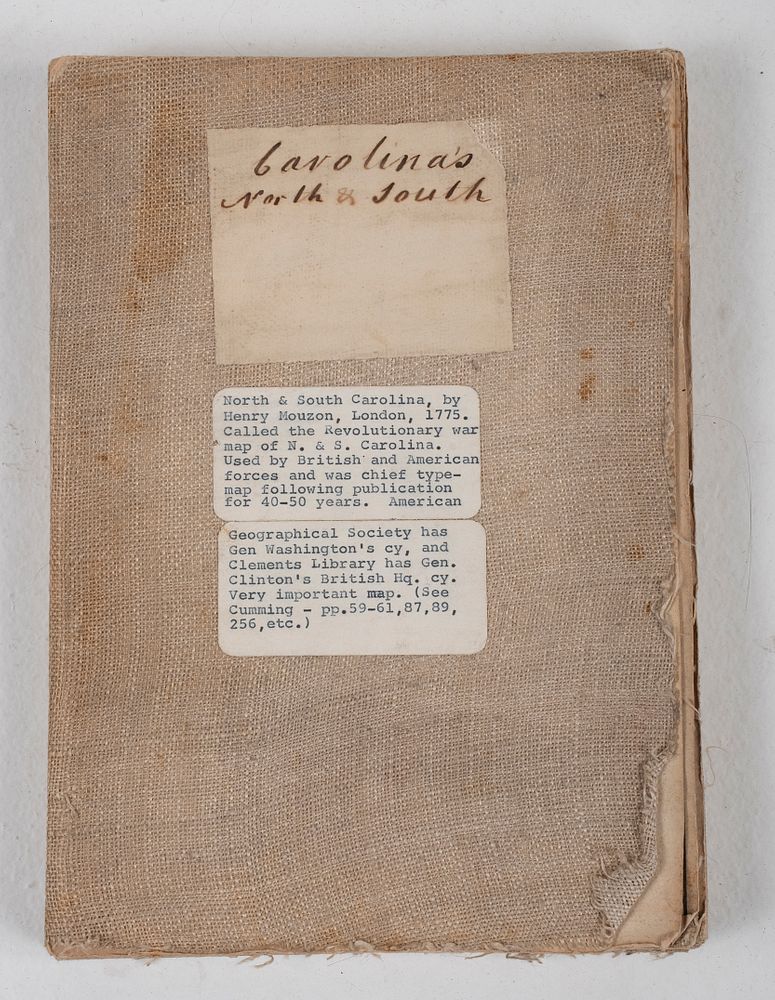
Provenance: Humber Family, North Carolina
Note: Regarded as one of the most significant maps of the Revolutionary War period, Mouzon's map of the Carolinas was consulted by American, English, and French commanders during the Revolution, with the personal copies of figures such as George Washington and Sir Henry Clinton now held in permanent collections. Though little is known about Mouzon's life, his map became a landmark work which was consulted and copied widely after its publication due to its level of detail and accuracy.
Literature:
Cumming, William, North Carolina in Maps, pp. 21-22
Cumming, William, The Southeast in Early Maps, #450, pp. 449-450
Pritchard and Taliaferro, Degrees of Latitude: Mapping Colonial America, #44, figures 163, 164, pp. 208-211
cut into panels (each approximately 10 x 7 in.) and laid on linen, some lifting and wear to paper edges, scattered staining throughout, linen with scattered staining, fraying, and other typical wear
Purchased items will be available for pick up or shipping from our Asheville, North Carolina auction facility within ten business days of the auction will be assessed a storage fee of $5.00 per day, per item. Purchaser agrees that packing and shipping is done at the purchaser's risk and that the purchaser will pay in advance all packing expenses, materials, carrier fees and insurance charges. At our discretion, items will either be packed by an agent such as a packaging store or Brunk Auctions. Please allow two weeks for shipping after payment is received. Shipment of large items is the responsibility of the purchaser. We are happy to provide names of carriers and shippers if a purchaser so requests. Brunk Auctions will have no liability for any loss or damage to shipped items.