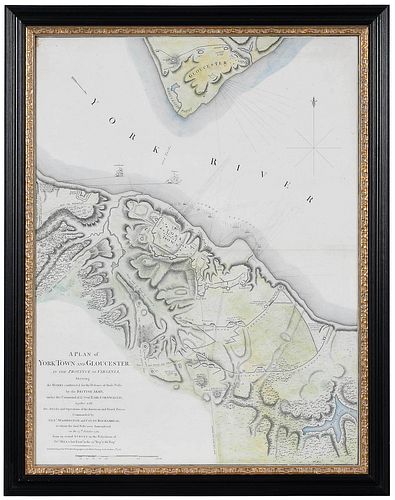
Lt. John Hills - Plan of Yorktown and Gloucester, 1785
Bid Increments
| Price | Bid Increment |
|---|---|
| $0 | $25 |
| $100 | $50 |
| $1,000 | $100 |
| $2,000 | $200 |
| $3,000 | $250 |
| $5,000 | $500 |
| $10,000 | $1,000 |
| $20,000 | $2,000 |
| $50,000 | $5,000 |
| $100,000 | $10,000 |
John Hills (surveyor, active 1777-1819), William Faden (publisher), A Plan of York Town and Gloucester, in the Province of Virginia, Shewing the Works Constructed for the Defence of those Posts by the British Army, under the Command of Lt. Genl. Earl Cornwallis, London, 1785, engraving on laid paper with hand colored highlights, sheet (margins folded) 28-1/4 x 21-1/2 in.; black painted and gilt wood frame, 32 x 25 in.
Note:
During his career, Lieutenant John Hills (23rd Regiment of Foot) produced more than fifty maps, some of which depicted battles that he did not witness firsthand. Hills often borrowed from other reliable surveyors, citing them in his work. It is unclear whether Hills personally compiled A Plan of York Town and Gloucester or whether this was the work of another engineer. As publisher William Faden indicated in the title, the source was an actual survey in the possession of John Hills.
Literature: William C. Wooldridge, Mapping Virginia, figure 157, p.175.
Provenance: Property deaccessioned by The Colonial Williamsburg Foundation; all proceeds to benefit The Joseph H. and June S. Hennage Fund
Condition
hinged in on mat with archival tape, left edge trimmed at plate line, other sheet edges folded back and taped with archival tape, reinforced at center join line with archival tape, light wear and minor handling creases, small stain at upper left corner; frame with light wear and abrasions
Available payment options
Purchased items will be available for pick up or shipping from our Asheville, North Carolina auction facility within ten business days of the auction will be assessed a storage fee of $5.00 per day, per item. Purchaser agrees that packing and shipping is done at the purchaser's risk and that the purchaser will pay in advance all packing expenses, materials, carrier fees and insurance charges. At our discretion, items will either be packed by an agent such as a packaging store or Brunk Auctions. Please allow two weeks for shipping after payment is received. Shipment of large items is the responsibility of the purchaser. We are happy to provide names of carriers and shippers if a purchaser so requests. Brunk Auctions will have no liability for any loss or damage to shipped items.


