Premier Catalog Auctions - Session III
Sat, Sep 15, 2018 09:00AM EDT

| Price | Bid Increment |
|---|---|
| $0 | $25 |
| $100 | $50 |
| $1,000 | $100 |
| $2,000 | $200 |
| $3,000 | $250 |
| $5,000 | $500 |
| $10,000 | $1,000 |
| $20,000 | $2,000 |
| $50,000 | $5,000 |
| $100,000 | $10,000 |
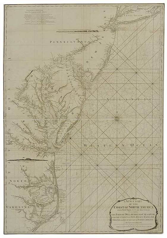
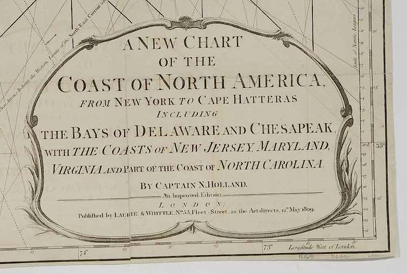
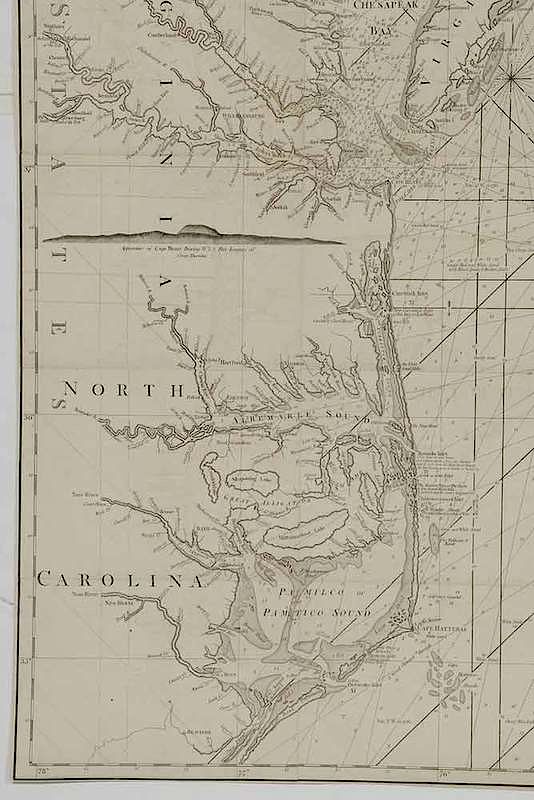
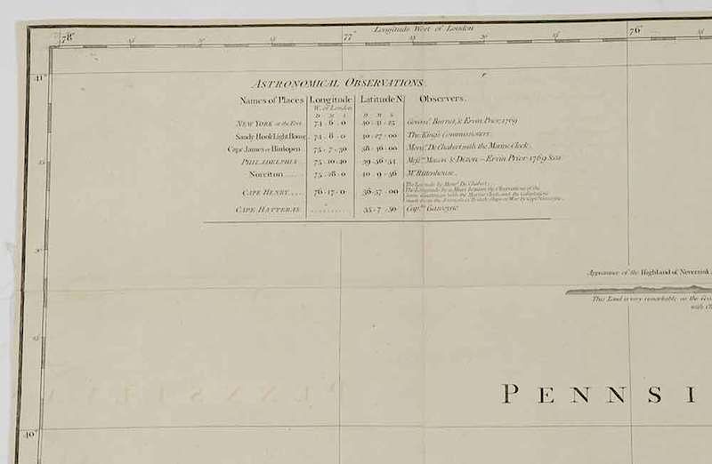
Captain N. Holland [Probably Samuel Holland (1728-1801)] A New Chart of the Coast of North America from New York to Cape Hatteras Including The Bays of Delaware and Chesapeak, With the Coasts of New Jersey, Maryland, Virgina and Part of the Coast of North Carolina by Captain N. Holland An Improved Edition, published in 1809 by Laurie and Whittle updated from the 1794 work, black and white line engraving with linen backing, 40-7/8 x 28-1/2 in (overall); unframed
NOte: This copy of the map is published in William C. Wooldridge, Mapping Virginia, figure 200 and 200a, pp. 220-223.
In the book, Wooldridge writes, "There is no record of a hydrographer named N. Holland in the imprints produced by any other firms; this may be an erroneous reference to Samuel Holland, who was a contemporary of Des Barres, an associate of Captain James Cook, and a notable figure in Canadian marine surveying. The 'error' if such it were, is unaccountably repeated on other maps by Laurie and Whittle, who certainly knew better." Despite the large scale of the map, there is considerable nautical detail of Hampton Roads and Chesapeake Bay. Earlier states of this map are in the collection of the New York Public Library, the Norman B. Leventhal Map Center at the Boston Public Library, and the Biblioteca Nacional de España.
, Provenance: Collection of William C. Wooldridge; Collection of the Virginia Cartographical Society, LC; deaccessioned by the Colonial Williamsburg Foundation, Williamsburg, Virginia with all proceeds to benefit the Collections Acquisitions Fund.In house shipping. Brunk Auctions provides in-house shipping via UPS Ground (signature required) for many items. Brunk Auctions will provide a shipping quote which includes shipping, materials, labor and insurance. Insurance is based on the selling price and premium.
In order to provide an accurate shipping quote please provide the following:
Shipping arrangements are made only after the invoice is paid. The payment for shipping is a separate charge from payment of your lots.
Sales Tax: If you live in North Carolina and/or pick up from the auction house, and do not have a valid resale tax number on file with us, you MUST pay North Carolina state sales tax. The NC Sales Tax will not apply to any items being shipped out of state (unless the client resides in North Carolina) or to those clients with a resale tax number.