Premier Auction
Sat, Mar 23, 2019 09:00AM EDT

| Price | Bid Increment |
|---|---|
| $0 | $25 |
| $100 | $50 |
| $1,000 | $100 |
| $2,000 | $200 |
| $3,000 | $250 |
| $5,000 | $500 |
| $10,000 | $1,000 |
| $20,000 | $2,000 |
| $50,000 | $5,000 |
| $100,000 | $10,000 |
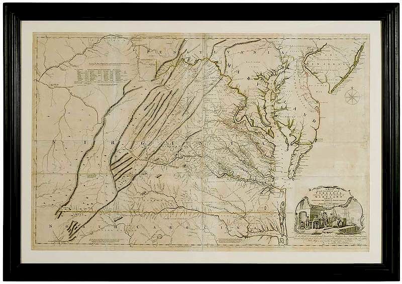
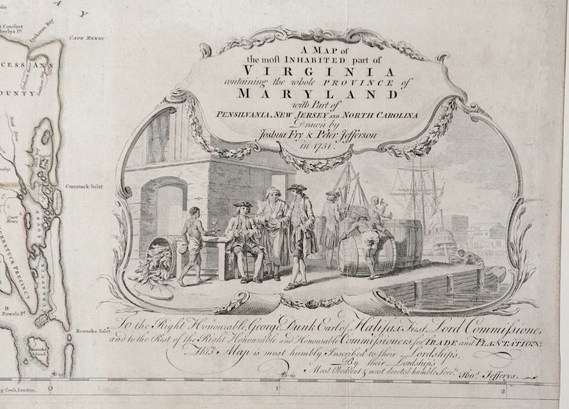
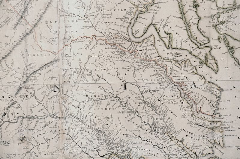
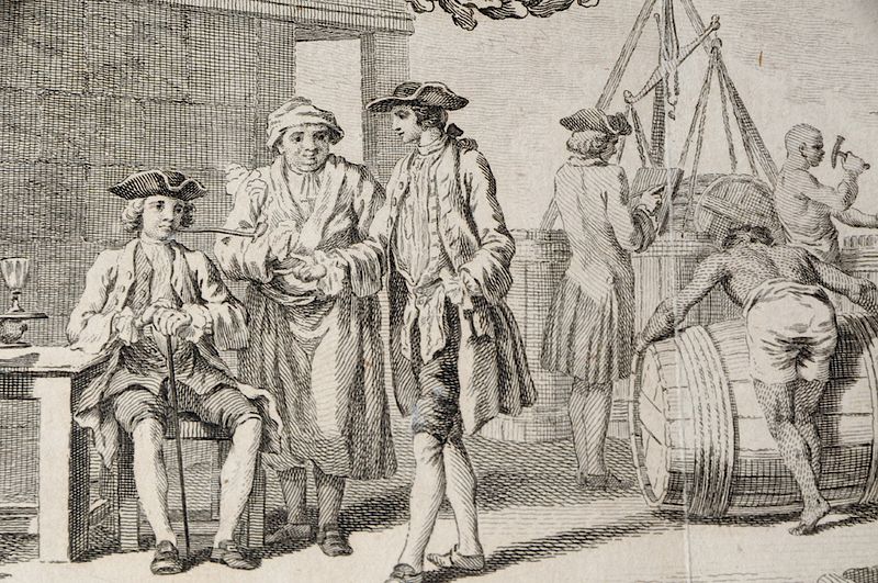
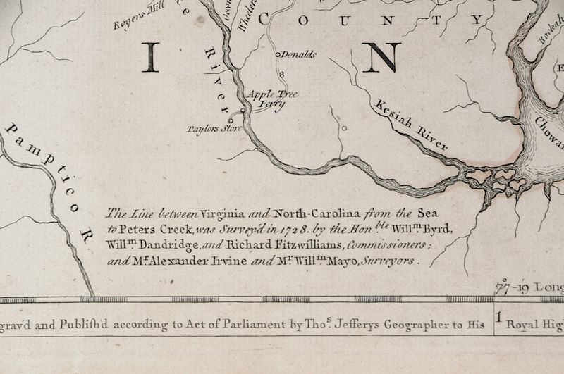
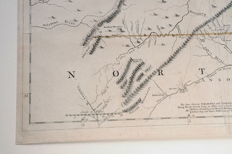
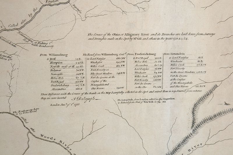
Joshua Fry (circa 1700-1754) and Peter Jefferson (1708-1757), [A Map of the most inhabited part of Virginia / containing the whole province of / Maryland / with part of Pensilvania, New Jersey and North Carolina / Drawn by Josua Fry & Peter Jefferson in 1751]; engraved and originally published by Thomas Jefferys in London, 1751, this copy, the 5th state was issued in 1768; with hand coloring; 31-1/2 x 48-1/2 in.; modern black frame, 47-1/2 x 57-1/2 in.
Provenance: Colonial Williamsburg Foundation (acquired 1981), Proceeds to Benefit the Acquisitions FundNote:For more on the Fry Jefferson map and its states, see Pritchard and Taliaferro, [Degrees of Latitude], catalog no. 30.
In house shipping. Brunk Auctions provides in-house shipping via UPS Ground (signature required) for many items. Brunk Auctions will provide a shipping quote which includes shipping, materials, labor and insurance. Insurance is based on the selling price and premium.
In order to provide an accurate shipping quote please provide the following:
Shipping arrangements are made only after the invoice is paid. The payment for shipping is a separate charge from payment of your lots.
Sales Tax: If you live in North Carolina and/or pick up from the auction house, and do not have a valid resale tax number on file with us, you MUST pay North Carolina state sales tax. The NC Sales Tax will not apply to any items being shipped out of state (unless the client resides in North Carolina) or to those clients with a resale tax number.