Premier Catalog Auctions - Session III
Sat, Sep 15, 2018 09:00AM EDT

| Price | Bid Increment |
|---|---|
| $0 | $25 |
| $100 | $50 |
| $1,000 | $100 |
| $2,000 | $200 |
| $3,000 | $250 |
| $5,000 | $500 |
| $10,000 | $1,000 |
| $20,000 | $2,000 |
| $50,000 | $5,000 |
| $100,000 | $10,000 |
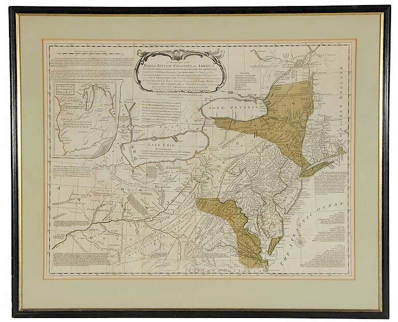
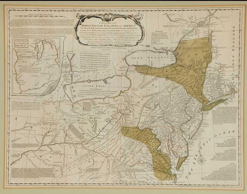
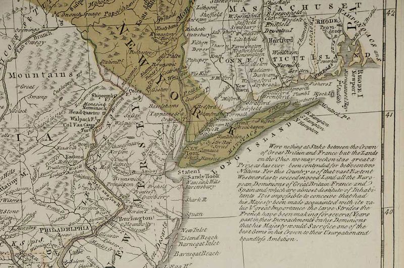
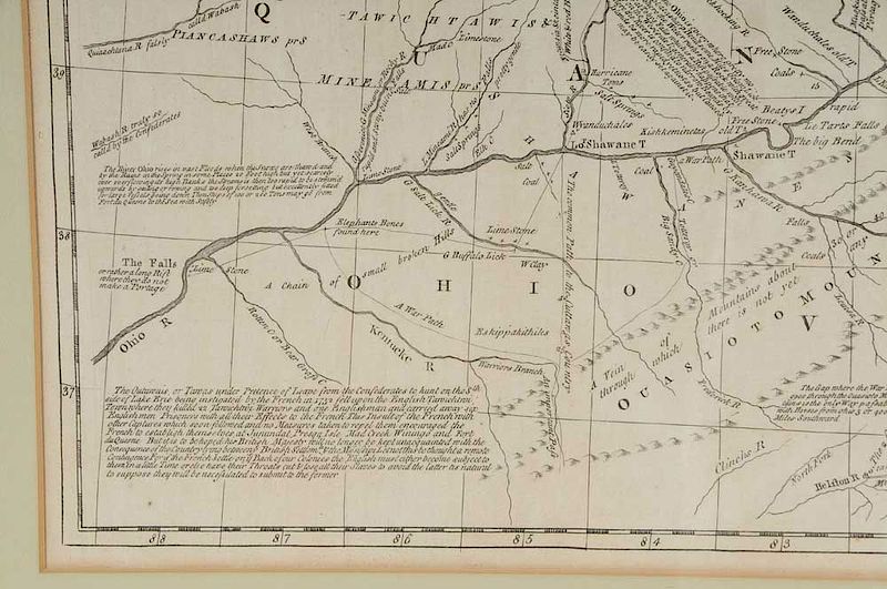
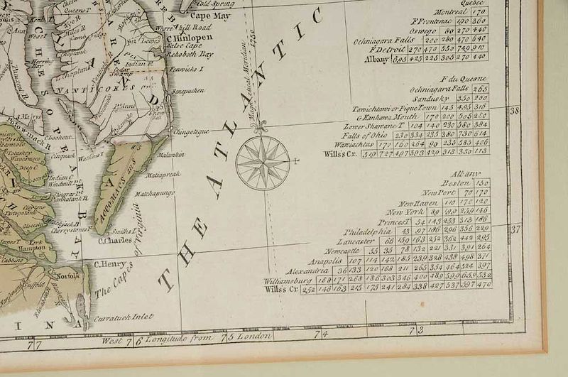
Lewis Evans (circa 1700-1756), A General Map of The Middle British Colonies in America Viz. Virginia, Maryland, Delaware, Pensilvania, New-Jersey, New York, Connecticut & Rhode-Island of Aquanshuonigy...;Jan. 1, 1771; black and white line engraving with period hand color on laid paper; 19-1/2 x 26 in.; framed
Note: For an earlier copy of this map, see Brunk Auctions, November 2017, Lot 1099.
Lewis Evans was the best geographer working in the English colonies in the mid-eighteenth century. Concerned over increased French activity on the frontier, Evans gathered sources in preparation for a new map of the middle colonies, placing his emphasis on the Ohio Valley, the region at the center of the friction between England and France.
Maps were rarely engraved and published in America during the colonial period, however Evans commissioned James Turner, a copperplate engraver who had recently moved to Philadelphia from Boston, to execute the work.
Evans’s map was widely accepted and copies were quickly pirated in London. The first plagiarized version appeared in 1756. In all, sixteen editions, all derived from Evans’s map and all piracies except for one, were published over the next sixty years.
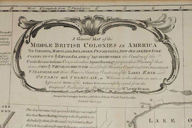
The Upper Cartouche Reads: A General MAP of the / MIDDLE BRITISH COLONIES IN AMERICA / Viz. VIRGINIA, MARYLAND, DELAWARE, PENSILVANIA, NEW-JERSEY, NEW YORK, / CONNECTICUT & RHODE-ISLAND of AQUANISHUONIGY the Country of the Confederate Indians Comprehending Aquanishuonigyproper; their Places of Resi- / dence, OHIO & THUCHSOCHRUNTIE their Deer Hunting Countries, COUCHSACHRAGE / & SKANIADARADE their Beaver Hunting Countries, of the LAKES ERIE / ONTARIO and CHAMPLAIN _ Wherin is also shewn the antient / & present Seats of the Indian Nations; carefully copied from the / Original Publish'd at Philadelphia by Mr. Lewis Evans.
The Area Below the Cartouche Reads: Printed for Carington Bowles, at No. 69 in St. Pauls Church Yard, London. / Publish'd Jany. 1.1771.
Literature:
Cresswell, Donald, H., "Colony to Commonwealth: The Eighteenth Century," in Stephenson, Richard W. and Marianne M. McKee, Virginia in Maps, pp. 53-54, 82;
Gipson, Lawrence Henry, Lewis Evans," 1939;
Klinefelter, Walter "Lewis Evans and His Maps," in Transactions of the American Philosophical Society, New Series, Vol. 61, No. 7, 1971), pp. 3-65;
Papenfuse, Edward C. and Joseph M. Coale III, The Hammond-Harwood House Atlas of Historical Maps of Maryland, 1608-1908, pp. 33-34;
Pritchard, Margaret B. and Henry G. Taliaferro, Degrees of Latitude: Mapping Colonial America, pp. 172-175;
Seymour I. Schwartz and Ralph E. Ehrenberg, The Mapping of America, pp. 162, 165, Plate 98
Wheat, James Clement and Christian F. Brun, Maps and Charts Published in America before 1800: A Bibliography ,pp. 65-66, #298.
, Provenance: Argosy Gallery, NYC; Private Collection, NCIn house shipping. Brunk Auctions provides in-house shipping via UPS Ground (signature required) for many items. Brunk Auctions will provide a shipping quote which includes shipping, materials, labor and insurance. Insurance is based on the selling price and premium.
In order to provide an accurate shipping quote please provide the following:
Shipping arrangements are made only after the invoice is paid. The payment for shipping is a separate charge from payment of your lots.
Sales Tax: If you live in North Carolina and/or pick up from the auction house, and do not have a valid resale tax number on file with us, you MUST pay North Carolina state sales tax. The NC Sales Tax will not apply to any items being shipped out of state (unless the client resides in North Carolina) or to those clients with a resale tax number.