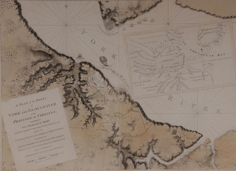
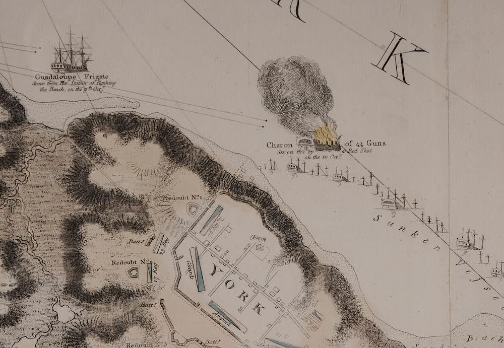
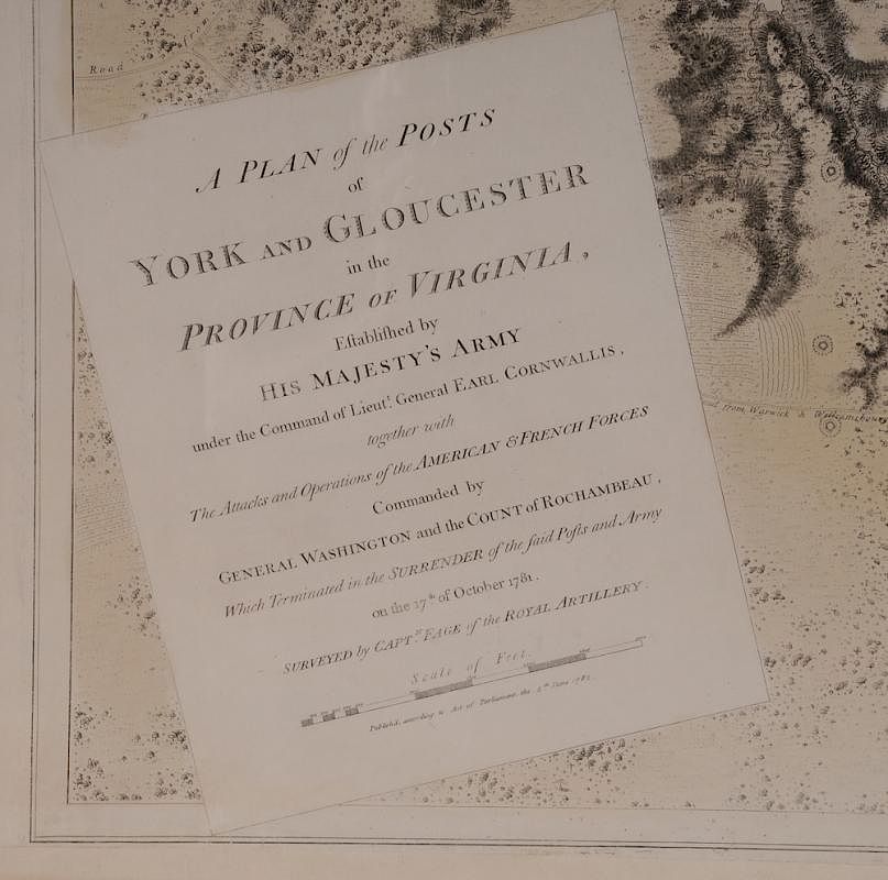
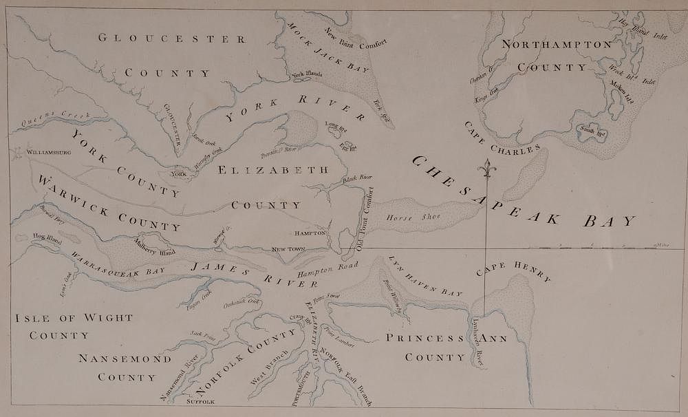
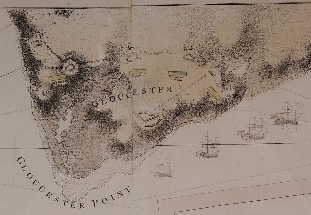
the Posts of York and Gloucester in the Province of Virginia. Established by his Majesty’s Army under the Command of Lieut. General Earl Cornwallis, together with the Attacks under Operations of the American & French Forces Commanded by General Washington and the Count of Rochambeau, which Terminated in the Surrender of the said Posts and Army on the 17th of October 1781. Surveyed by Captn. Fage of the Royal Artillery]
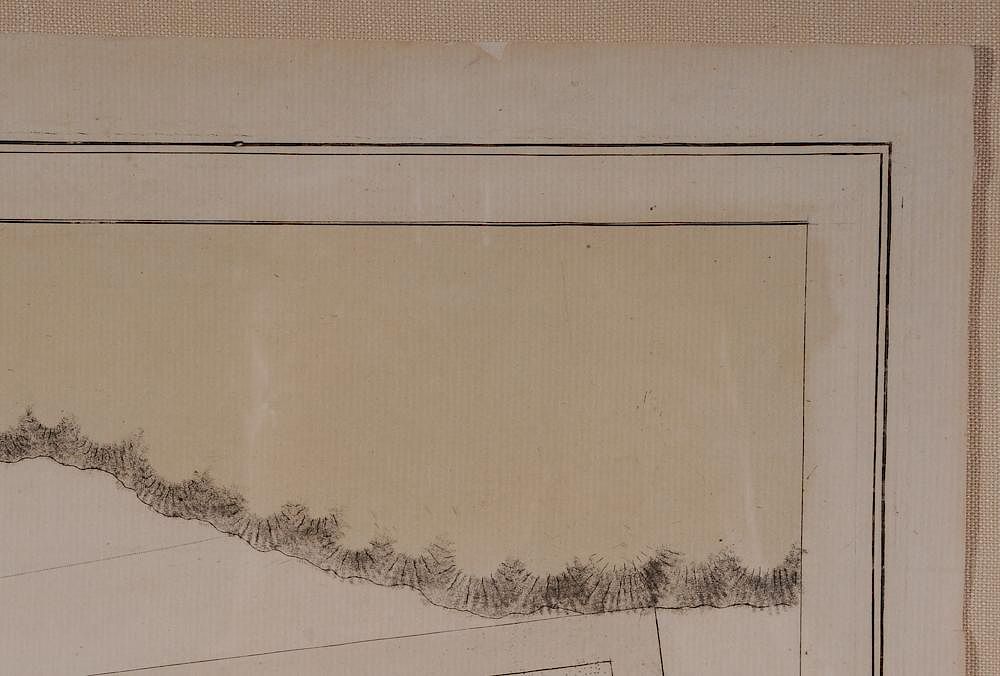
published according to Act of Parliament, the 4th June 1782, full period color, 29-7/8 x 40-3/4 in., inset of the lower Chesapeake and the lower courses of the York and James rivers, from Des Barres’ [Atlantic Neptune] very good condition overall, with only slight toning and foxing (largely confined to margins), small archival repair in lower margin at seam, false margin attached at lower edge, scattered edge flaws, expected crease at center (see detailed photos). Notes: Exhibited: The New York Historical Society, 2003; The Milwaukee Art Museum, 2003; The Concord Museum 2003; and Colonial Williamsburg Foundation, 2003-2004.
Literature: Pritchard & Taliaferro, [Degrees of Latitude, 66]; Verner, “Maps of the Yorktown Campaign 1780-1781” The Mapping of America, (pps. 217-277), p. 252; Verner, (unpublished) [The Printed Maps of Virginia 1590 to 1800], Vol. 5, no. 788; Rich, Bibliotheca Americana, I, p. 249; see Hornby, [Surveyors of Empire Samuel Holland, J. F. W. Des Barres and the Making of the Atlantic Neptune, Phillips, Atlases in the Library of Congress, 1198-1204].
The [Atlantic Neptune] is the "most splendid collection of charts, plans and views ever published" (Rich). It was published at the charge of the British government for the use of the British Navy, and no expense appears to have been spared in the execution in order to render it a monument worthy of the nation. Due to the great cost of publication, this multi-volume atlas would probably have never seen the light of day if not for the worsening conditions in the American Colonies. It was imperative for the Admiralty to have a worthy sea atlas for the use of its fleet in American waters. Even then the work progressed slowly. The earliest charts were separately published and distributed to the Navy in 1775. New charts appeared regularly over the next seven years, with the emphasis shifting according to the course of events during the Revolution. Approximately 160 charts were produced before publication ceased in 1782, and no two examples of the atlas have the same collation.
The [Plan of the Posts of York and Gloucester], dated 4th June 1782, was the last of the charts to be published. Very few copies were printed before the atlas was discontinued, and it is an extraordinary rarity. The map was included in only one of the thirteen sets of the Atlantic Neptune at the Library of Congress examined by Coolie Verner. It is the "first British prototype to detail the situation around Yorktown at the time of the surrender" (Verner, [Yorktown], p. 251). The second, by William Faden, did not appear until 1785.
Brunk Auctions wishes to thank Henry Taliaferro for his kind assistance in cataloging this lot.. Provenance: Colonial Williamsburg Foundation, Williamsburg, Virginia, Proceeds to benefit the Acquisitions Fund
Condition
very good condition overall, with only slight toning and foxing (largely confined to margins), small archival repair in lower margin at seam, false margin attached at lower edge, scattered edge flaws, expected crease at center (see detailed photos)