November Premier Auction: Day 3
Sat, Nov 11, 2017 09:00AM EST - Sun, Nov 12, 2017 09:00AM EST
| Price | Bid Increment |
|---|---|
| $0 | $25 |
| $100 | $50 |
| $1,000 | $100 |
| $2,000 | $200 |
| $3,000 | $250 |
| $5,000 | $500 |
| $10,000 | $1,000 |
| $20,000 | $2,000 |
| $50,000 | $5,000 |
| $100,000 | $10,000 |
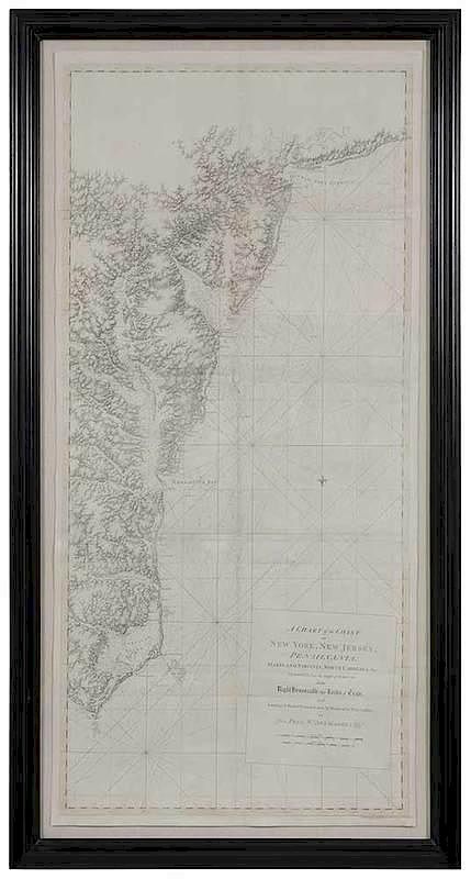
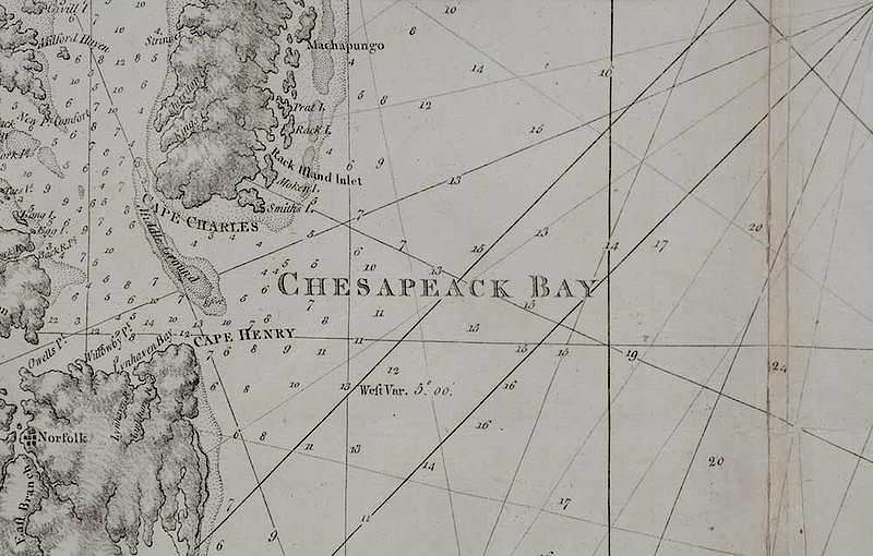
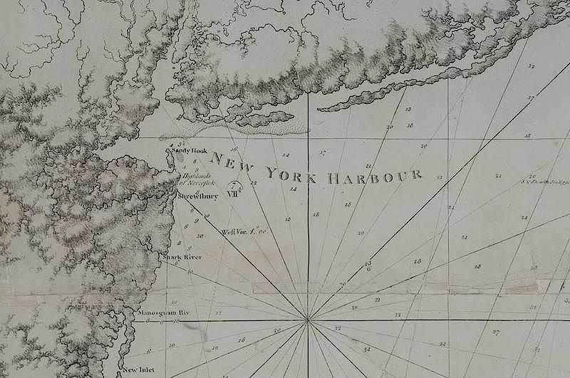
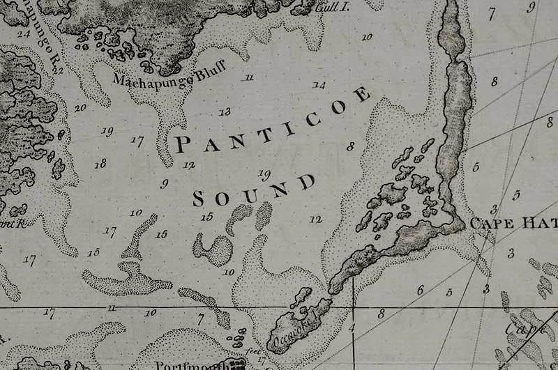
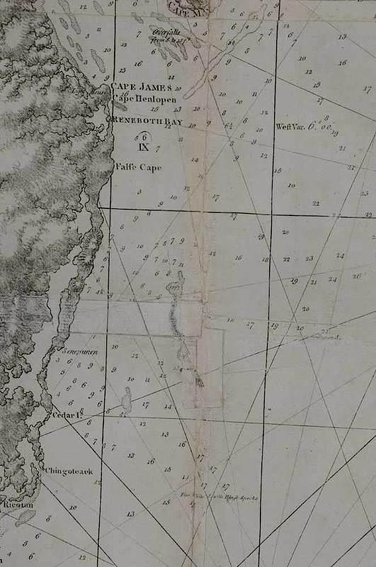
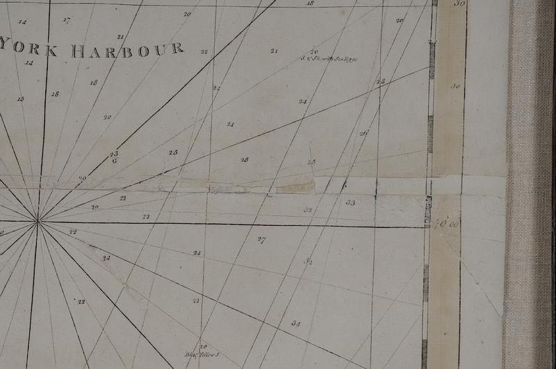
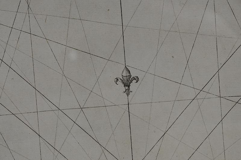
Joseph Frederick Wallet Des Barres (1721-1824) A Chart of The Coast of New York, New Jersey, Pensilvania, Maryland, Virginia, North Carolina, &c..., March 1, 1780, published in the Atlantic Neptune, state 1, black and white line engraving on laid paper, 62-5/8 x 29-1/2 in. (overall); framed Notes: This copy of the map is published in Margaret B. Pritchard and Henry G. Taliaferro, Degrees of Latitude: Mapping Colonial America, no. 61, pp. 266-269. The outbreak of the Revolution created an urgent need for Des Barres’s coastal charts. When the focus of Britain’s military campaign shifted to the southern front early in 1780, this chart provided the royal navy with data essential to maneuvering in the coastal waters of the mid-Atlantic region. The most complete information is in the Chesapeake Bay area where numerous shoals and spits of sand at the mouths of its major tributaries created challenges to navigation. Like most of Des Barres’s charts, little topography was illustrated beyond the shoreline; however, close attention was paid to rendering the nature of the coast and to furnishing accurate soundings. The lower right cartouche reads: A CHART of the COAST/ OF/ NEW YORK, NEW JERSEY,/ PENSILVANIA,/ MARYLAND, VIRGINIA, NORTH CAROLINA, &c./ COMPOSED from the deposit of SURVEYS/ of the/ Right Honourable the Lords of Trade./ with/ Soundings & Nautical Remarks from L.t Jn.o Knight of the Navy & others/ BY/ JOS. FRED. W. DES BARRES Esq.r The lower right margin reads: Publish'd According to Act of Parliament March 1. 1780. by J.F.W. Des Barres Es[?] Exhibited: Degrees of Latitude: Mapping Early America Milwaukee Art Museum, Wisconsin, March 21, 2003 - June 22, 2003. Concord Museum, Massachusetts, July 10, 2003 - October 19, 2003. Literature: Cumming, William P., The Southeast in Early Maps, pp. 51-56, 71. Evans, Geraint Nantglyn Davies, Uncommon Obdurate: The Several Public Careers of J. F. W. Des Barres,; Harley, J. B., "The Map User in the Revolution" in Harley, J. B., et al., Mapping the American Revolutionary War,, pp. 87-91. Morrison, Russell, et al., On the Map: An Exhibit and Catalogue of Maps Relating to Maryland and the Chesapeake Bay, pp. 66-67, Figure 41; Sellers John R. and Patricia M. Van Ee, Maps and Charts of North America and the West Indies, 1750-1789, pp. 162-163, #766. Provenance: Colonial Williamsburg Foundation, Proceeds to Benefit the Acquisitions Fund
floated, minor staining along glue joint, some losses with restoration work along creases with inserts; minor fading, toning, and page transfer
In house shipping. Brunk Auctions provides in-house shipping via UPS Ground (signature required) for many items. Brunk Auctions will provide a shipping quote which includes shipping, materials, labor and insurance. Insurance is based on the selling price and premium.
In order to provide an accurate shipping quote please provide the following:
Shipping arrangements are made only after the invoice is paid. The payment for shipping is a separate charge from payment of your lots.
Sales Tax: If you live in North Carolina and/or pick up from the auction house, and do not have a valid resale tax number on file with us, you MUST pay North Carolina state sales tax. The NC Sales Tax will not apply to any items being shipped out of state (unless the client resides in North Carolina) or to those clients with a resale tax number.