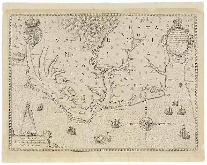
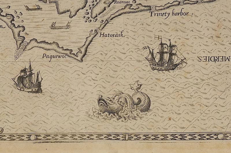
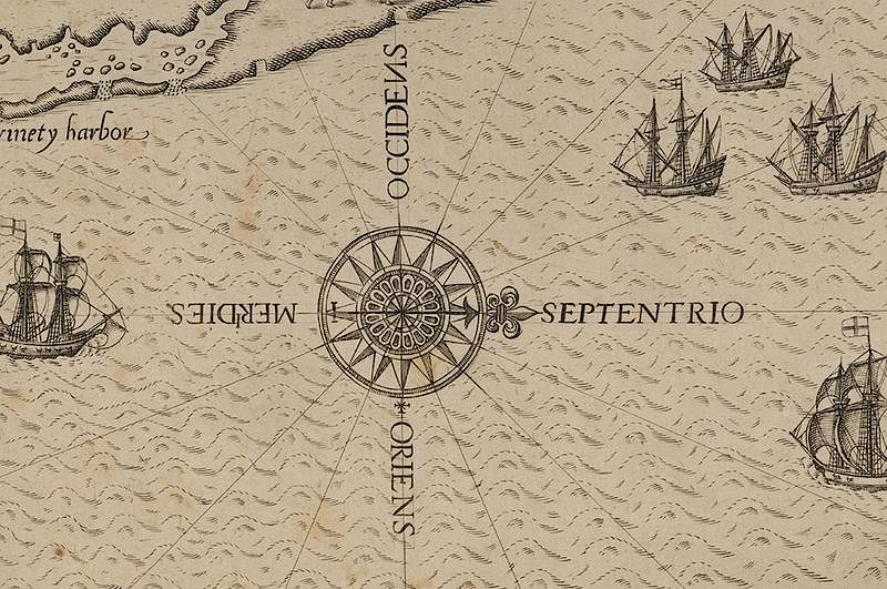
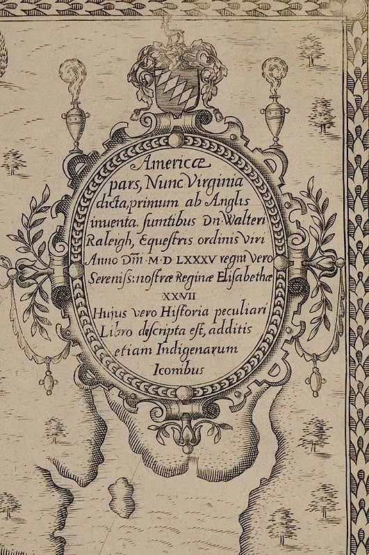
Theodore De Bry (1528-1598), after a work by John White (fl. 1585-1593) Americæ pars, Nunc Virginia dicta, primum ab Anglis inuenta. sumtibus Dn. Walteri Raleigh, Equestris ordinis viri Anno Dñi · M D · LXXXV regni vero Sereniss: nostræ Reginæ Elizabethæ XXVII Hujus vero Historia peculiari Libro discripta est, additis etiam Indigenarum Iconibus, from a 1590 publication of Admiranda Narratio fida tamen, de Commodis et Incolarum Ritibus Virginiae, black and white line engraving, 12 x 16-1/2 in. (plate), 13-7/8 x 17-5/8 in. (overall); unframed
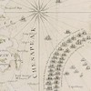
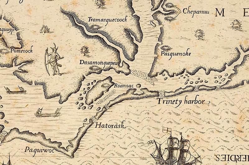
Notes: Queen Elizabeth I granted Sir Walter Raleigh a charter enabling him to settle an English colony in America in 1584. The colonists established their headquarters on Roanoke Island on the Outer Banks of North Carolina, naming the region Virginia. John White, sent to draw and record the geography, natives, and natural history of the area, delineated the region between the mouth of the Chesapeake Bay and Cape Lookout, North Carolina. His map was the first printed English record of Raleigh’s attempts to plant a colony in the New World and the first to include the name Chesepiooc Sinus.
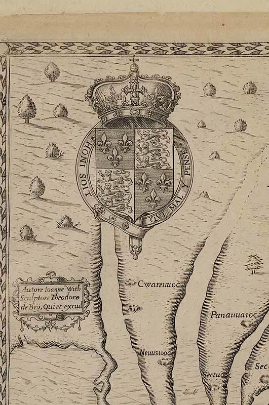
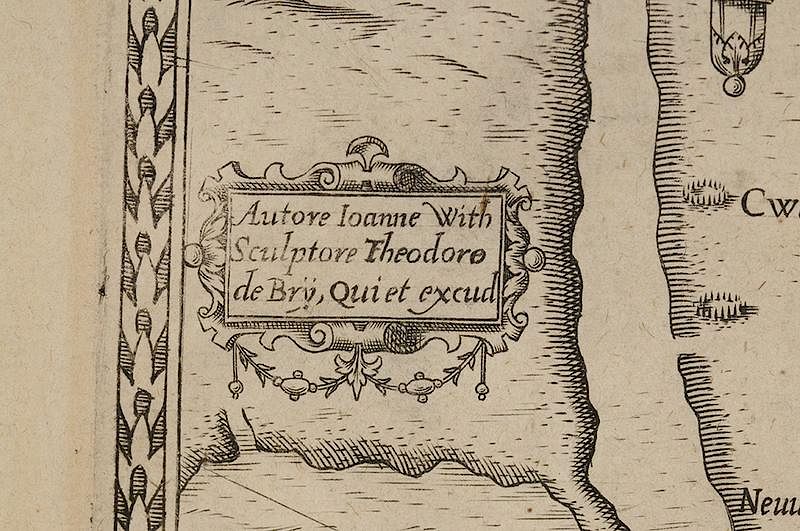
The center left cartouche reads: Autore Ioanne With/ Sculpture Theodore/ de Bry, Qui et excud
Literature: Burden, Philip D., The Mapping of North America, pp. 96-98, #76; Cumming, William P., Mapping the North Carolina Coast: Sixteenth-Century Cartography and the Roanoke Voyages, pp. 48-57; Cumming, William P., The Southeast in Early Maps, p. 123-124, #12; W. P. Cumming, R. A. Skelton, and D. B. Quinn, The Discovery of North America, pp. 178-180, 185, 193-205; Hulton, Paul, Images of the New World: Jacques Le Moyne de Morgues and John White; Morrison, Russell, et al., On the Map: An Exhibit and Catalogue of Maps Relating to Maryland and the Chesapeake Bay, pp. 4-5, Figure 3; Pritchard, Margaret B. and Henry G. Taliaferro, Degrees of Latitude: Mapping Colonial America, pp. 60-61, #2; Schwartz, Seymour I. and Ralph E. Ehrenberg, The Mapping of America,, pp. 76-77, Plate 37; Suárez, Thomas, Shedding the Veil: Mapping the European Discovery of America and the World,, #39; Wallis, Helen, Raleigh and Roanoke: The First English Colony in America, 1584-1590; Wooldridge, William C., Mapping Virginia.
Provenance: Colonial Williamsburg Foundation, Proceeds to Benefit the Acquisitions Fund
Condition
remnants of hinging verso, toning (possibly from mat), three reinforced edges, evident losses in margins restored, foxing, pin-sized hole in lower right margin, two minor tears in bottom margin, fleur-de-lis watermark visible when held to light