Premier Auction
Sat, Mar 23, 2019 09:00AM EDT
| Price | Bid Increment |
|---|---|
| $0 | $25 |
| $100 | $50 |
| $1,000 | $100 |
| $2,000 | $200 |
| $3,000 | $250 |
| $5,000 | $500 |
| $10,000 | $1,000 |
| $20,000 | $2,000 |
| $50,000 | $5,000 |
| $100,000 | $10,000 |
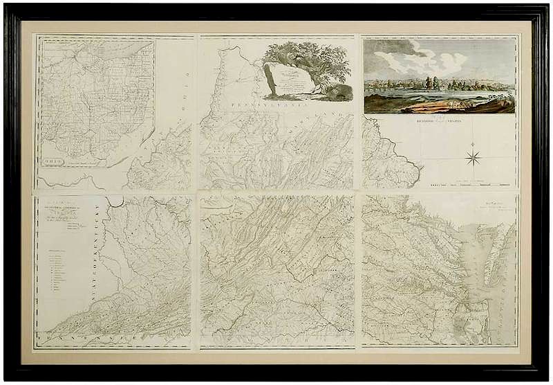
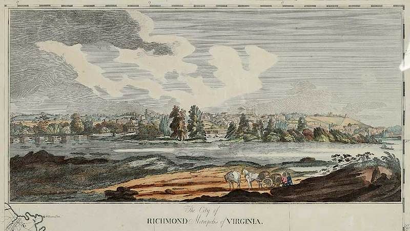
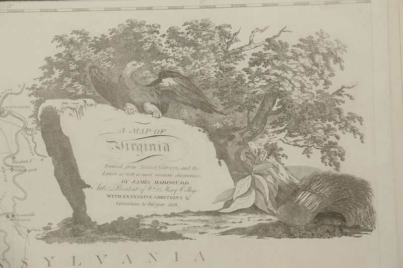
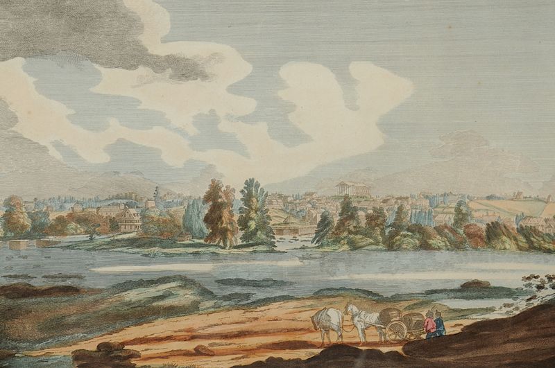
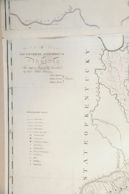
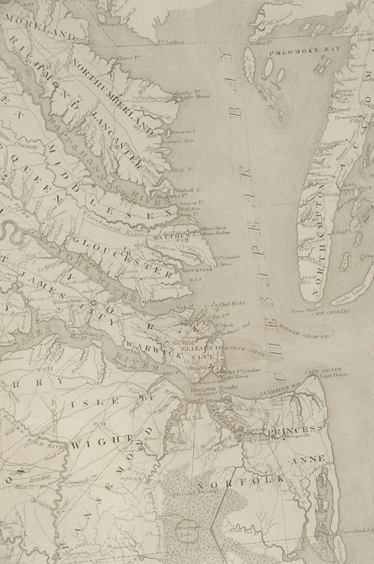
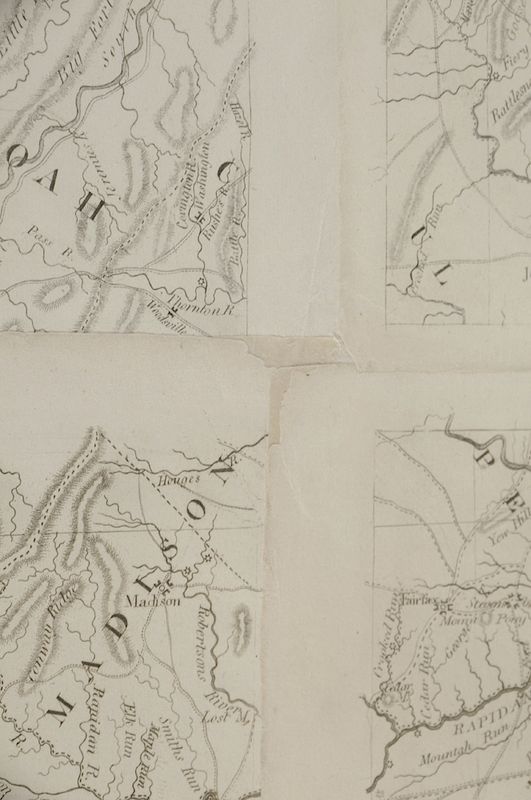
(1749-1812), a rare and important southern map, [A Map of Virginia / Formed from Actual Surveys, and the / Latest as well as most accurate observations, By James Madison, D.D. / Late President of W.m & Mary College / With Extensive Additions & / Corrections to the Year 1818., 1818], [To the General Assembly of Virginia, This Map is Respectfully Inscribed by their Fellow Citizens, James Madison, William Prentis, William Davis, Proprietors], black and white engraving with hand colored landscape view of [The City of Richmond, Metropolis of Virginia] (typically found in the second edition), [Copy Right Secured Published Richmond Mar 4, 1808 / By the Proprietors], printed in six separate sections and then assembled, includes State of Ohio, State of Kentucky and portion of Michigan Territory, 41 x 71-1/2 in.; black painted frame, 55-3/4 x 80 in.
Provenance: Colonial Williamsburg Foundation (acquired 1990), Proceeds to Benefit the Acquisitions FundNote:This extremely rare map was acquired by Colonial Williamsburg directly from a descendant of the printer. As such, this is perhaps the only known copy of Madison’s map to survive as it was issued in six individual sheets with uncut margins. The map was carefully assembled for exhibition by Colonial Williamsburg’s paper conservator so that it retains the margins. The fine condition of this example surpasses any other known copy of the map.
References include: [Degrees of Latitude, Mapping Colonial America], by Margaret Beck Pritchard and Henry G. Taliaferro: The Colonial Williamsburg Foundation and Henry M. Abrams, New York, 2002. Pages 308-311, with illustrations. "Aware of the need for a new scientific map of Virginia, Madison assumed the task of gathering data for the project. His goal was to improve earlier observations of latitude and longitude, to ensure the correctness of newly formed county boundaries, to gather the most up-to-date information on the courses of rivers and bearings on mountains from regional surveys and to depict the state's boundaries accurately.", page 311.
In house shipping. Brunk Auctions provides in-house shipping via UPS Ground (signature required) for many items. Brunk Auctions will provide a shipping quote which includes shipping, materials, labor and insurance. Insurance is based on the selling price and premium.
In order to provide an accurate shipping quote please provide the following:
Shipping arrangements are made only after the invoice is paid. The payment for shipping is a separate charge from payment of your lots.
Sales Tax: If you live in North Carolina and/or pick up from the auction house, and do not have a valid resale tax number on file with us, you MUST pay North Carolina state sales tax. The NC Sales Tax will not apply to any items being shipped out of state (unless the client resides in North Carolina) or to those clients with a resale tax number.